
Algonquin Provincial Park
|
Algonquin Provincial Park
|
||
 Algonquin Park information sign |
||
| location | Ontario (Canada) | |
| surface | 7725 km² | |
| WDPA ID | 4167 | |
| Geographical location | 45 ° 35 ′ N , 78 ° 20 ′ W | |
|
||
| Setup date | 05/23/1893 | |
| administration | Ontario parks | |


The Algonquin Provincial Park is a 7725 km² nature reserve in the Canadian province of Ontario . The park not only has deciduous and coniferous forests, but also swamps and towering cliffs and over 2,400 lakes. It is located north of Lake Ontario in a triangle between the cities of Greater Sudbury in the west, Toronto in the south and Ottawa in the east. Toronto is about 200 km as the crow flies. The park is the oldest natural park in Ontario and was declared a National Historic Site of Canada in 1992 . The park is part of the much larger Frontenac Arch biosphere reserve , which was created in 2002 and which also includes the Thousand Islands National Park .
The Highway 60 runs on 60 km route (from east to west gate to) through the southern park. There are large campsites, a visitor center, and a lumberjack museum along this road . The nearest towns are Huntsville and Dwight in the Muskoka area to the west and Whitney in the Ottawa Valley to the east.
Algonquin Provincial Park is a popular recreational destination for Canadians, especially from Toronto and Ottawa, but also a tourist magnet. Around 750,000 tourists visit the park each year and go on day or multi-day hikes or canoe tours. About three thousand moose , about two thousand black bears , wolves and beavers live in the park . The beaver population is around 30,000 animals.
In addition to camping, the park also offers opportunities for photography, bird watching, hiking and fishing. Numerous long-distance hiking trails lead hikers to the most remote parts of the park and over 1600 km of canoe routes and around 1500 camp sites invite you to spend the night in the park.
History of the park

After the last ice age , about eleven thousand years ago, the landscape of today's Algonquin Provincial Park with its rocky cliffs, rivers and lakes was created. About nine thousand years ago, the first people, the natives of North America, a hunter-gatherer culture settled here .
Samuel de Champlain was arguably the first European in the area, a cartographer commissioned by the French government . Until 1829 no news appeared in the sources, even if we had to expect rangers . It was not until Alexander Shirreff visited and described the area in 1829. Almost at the same time the cartographer David Thompson visited it . A few years later, the Ottawa logging companies worked their way north along the rivers, that is to say mainly on Bonnechère , Petawawa and Madawaska . The precise maps from John Snow, for example, were very helpful. Around 1879 attempts were made to open up and divide the land for settlers. In its heyday, there were more than 29 farms and villages in the park area. However, the soil was sparse and agricultural use was almost impossible, so that many farmers left the area and left the space to the trappers and loggers . Mainly beaver pelts and Weymouth pines were special trade goods at that time, which were mined in an uncontrolled manner and therefore also led to a severe decimation of the population.


The pines were floated in the spring across the Ottawa River and the St. Lawrence River to the port cities of the nearby province of Québec , from where they were shipped to Europe, mainly England, as lumber. In addition to the uncontrolled fur hunt, some forest fires also devastated the area of today's park, so that only a few specimens remained of the formerly common Weymouth pine stocks.
It was not until the end of the 19th century that the then Canadian government initiated the first nature conservation measures and the Algonquin Provincial Park was founded in 1893. The government enforced a migration of the settlers from the park and also controlled fur hunting in the park. In the wood industry , too, the intervention of the Canadian government and the Canadian industrialist JR Booth brought about a sudden change: The Weymouth pines (Pinus Strobus) were now subject to protection and other types of wood in the park became interesting for industry. JR Booth employed over six thousand workers during the prime of his company and operated a railroad network in the park. By 1908, William Bell drew the first map for canoeists, the mode of transport that in large parts was the only one that allowed locomotion. The portages were recorded for the first time.
From the beginning of the 20th century, the conditions of use for the park area slowly changed. More and more tourists and people in need of relaxation discovered the natural beauty of the park and it was increasingly used as a recreation and holiday area. Luxury hotels were built next to campsites and storage areas for canoeists. In 1934, maps were first produced using aerial photography.
In the 1950s and 1960s a massive conflict of interests arose between the woodworking industry and the leisure industry, which was only resolved in 1974 by the Canadian government and a compromise:
The park was divided into four zones:
- Nature conservation and historical zones (geography, nature, history) approx. 6%
- Wilderness zone approx. 12%
- Developed zone (camping, hotels etc.) approx. 4%
- Leisure and usage zone (camping, logging) 78%
The woodworking industry is subject to the restriction that no logging work may be carried out in the immediate vicinity of lake shores and canoe trails ( portages ).
The seasons in the park
The park can be visited all year round, but parts of the area are closed to visitors in winter, from October to around April. The campsite at Mew Lake, the day use areas and Highway 60 can be used all year round.
In the spring after the snow melts, it is possible to use all parts of the park again. The biodiversity of the flowers and colorful spring bloomers are striking at this time. Moose can be seen on the highway because they drink the salty meltwater standing in puddles. Anglers can catch lake or brown trout on the lakes and streams. Some can weigh up to seven kilograms.
Most visitors come in summer and use the long-distance and day hiking trails, canoe routes and campsites. Black flies and mosquitoes are to be expected on the waters in June and July . The Logging Museum explains the history of forestry in the park. A 1.5 km long tour leads past, among other things, a replica lumberjack camp and a steam-powered skidding machine. The visitor center, opened in 1993, offers an exhibition on natural history and the history of human settlement. There is also a restaurant and a bookstore, and parking permits for cars can also be purchased here.
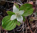
Cornus canadensis

mushroom
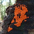
Mushrooms
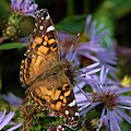
butterfly


Autumn is the time when the leaves of the sugar maple change color and conjure up an extraordinary play of colors on the trees. Now the howling of the wolves can be heard and it is possible that moose will be spotted.
From around November it starts to snow in Algonquin Park. The snow cover can pile up to about one meter high by mid-winter. The lakes formed a layer of ice by Christmas. Winter in Algonquin Provincial Park offers the opportunity to go cross-country skiing or take leisurely trips with snowshoes and dog sledding. Temperatures as low as minus 40 degrees Celsius can sometimes be reached.
Hiking trails
There are thirteen hiking trails in Algonquin Provincial Park of varying lengths and levels of difficulty. The shortest path is the Hardwood Lookout Path with a length of approx. 0.8 km, for which a walk of approx. 45 minutes should be planned. By a labeled single vantage point, you can get a beautiful view of the Smoke Lake enjoy and especially in May when the flowers of spring flowers peeping and in September / October, when the leaves of the sugar maple trees get their autumn colors, it is worth this trail along to climb steep slopes. The longest path, around eleven kilometers in length, is the Mizzy Lake Trail , for which a single hiker should plan around five hours. The hiker can sometimes cross swamps via wooden walkways and visit the banks of small rivers to observe various species of animals such as elk , fox , loons , chipmunks , wolves , black bears and raccoons . Here are the individual hiking trails:
- Whiskey Rapids Path
- Hardwood Lookout Path

- Mizzy Lake Trail
- Peck Lake Path
- Track-and-tower path
- Hemlock Bluff Path
- Bat Lake Path
- Two rivers path
- Lookout path
- Booth's Rock Path
- Spruce Bog Path
- Beaver Pond Path

- Centennial Ridges Path
Long-distance hiking trails
The long-distance hiking trails are the Highland Long-Distance Hiking Trail, the Western Uplands and the Eastern Pines Loop with lengths from 6 to 88 km. Starting points for these trails are at Grand Lake, Highway 60, and Rain Lake, as well as at the west entrance of the park.
Bike lanes
In addition to long-distance hiking trails and hiking trails and canoe routes, there are also bicycle paths in the park. The Minnesing Mountain Bike Path and the Old Railway Bicycle Path are two of the shorter routes that day tourists can also ride.
Lakes in the park
These lakes can be reached directly from Highway 60:
- Amikeus Lake
- Brewer Lake
- Canoe Lake
- Cedar Lake
- Coot Lake
- The Lake of Two Rivers is located south of Highway 60 and about 35 kilometers from the west and 13 miles from the east entrance of the park. At the lake itself there is a picnic area with a beach and a campsite. One of the three lodge hotels in the park is located on a peninsula. An open air theater is on the eastern side of the lake. Here, in the summer, the rangers stage the howling of wolves once a week in the evening, and when wolves are nearby, they even respond. Coming from Cache Lake, the Lake of Two Rivers is fed by the North Madawaska River, which ends here at the lake. On the southern shore of the lake, the approximately 5.1 km long Booths Rock Trail leads along to Pog Lake, south to Whitefish Lake and Rock Lake, where it ends in a loop. The Highland long-distance hiking trail passes around two kilometers away. The Two Rivers Path, 2.1 km in length, is on the north side of Highway 60 directly across the street and offers a view of the lake. There are numerous opportunities to practice water sports, but only boats up to 20 hp are permitted. Water skiing and jet skiing are not allowed for nature conservation reasons.
- Linda Lake
- Mizzy Lake
- North Tea Lake
- Opeongo Lake
- Peck Lake
- Radiant Lake
- Rain Lake
- Smooth Lake
- Source Lake
- Tea Lake is north of Highway 60 about seven miles from the western and 45 km from the eastern entrance. The Tea Lake Campground is located southeast of the lake between Highway 60 and the lake. There is also a picnic area at the southwestern end of the lake, which can be used by day tourists. From there it is not far to the Whiskey Rapids Path, which offers a view of the Algonquins landscape over its 2.1 km. The Tea Lake is fed by the Amable du Fond and flows into the lake via the Tea Falls. It has a few small islands that were created over the centuries by flooding and currents and that can only be reached by canoe. A cave that can be reached by canoe can also be visited. The lake's water drains over the Oxtongue River into Canoe and Smoke Lake.
- Whitefish Lake
Rivers
The sources of these rivers are in the protected areas of the park:
- Madawaska River
- Muskoka River
- Magnetawan River
- Amable du Fond River
- Petawawa River
- Bonnechere River
- York River
Leisure opportunities in the park

Hiking and camping are very important in Algonquin Provincial Park. At many campsites and also on overnight accommodations in the middle of the park, visitors have the chance to relax after a strenuous tour by canoe , kayak or even on foot. The numerous portages between the lakes, long-distance hiking trails and hiking trails are used in many ways by tourists and locals in spring and summer, and offers such as swimming, cycling and paddling courses for inexperienced and inexperienced canoeists are also offered.
The numerous lakes and rivers are ideal for fishing, and there are opportunities to observe and photograph animals in all seasons. In winter, activities such as dog sledding , cross-country skiing and ice fishing as well as walks on snowshoes through the wintry landscape are available.
research
Science has been practiced in the park since the 1930s. There are four research facilities: Harkness Laboratory of Fisheries Research , Wildlife Research Station , Timber Research Station, and the Visitor Information Center. Over 1,800 scientific papers have been published covering a wide range of topics, including: a. Biology, geology, forestry, history.
Because of the remote region and the easy and quick way to get to the park from the headquarters of the National Research Council in Ottawa, the Algonquin Radio Observatory (ARO) was opened in 1959 and is now operated by a private company for research purposes.
literature
- Wayne Van Sickle: Algonquin Park Canada Nature Park Guide, Stonecutter Press, Elmira, Ontario, 1971 (1999, 4th edition), ISBN 0-9684005-0-7 .
- Track and Tower Trail A Look into Algonquin's Past, The Friends of Algonquin Park 2004, ISBN 1-895709-99-7 .
- Names of Algonquin. Stories behind the Lake and Place Names of Algonquin Provincial Park, The Friends of Algonquin Park 1997, ISBN 1-895709-38-5 .
Web links
- Algonquin Provincial Park ( English, French ) In: The Canadian Encyclopedia .
- http://www.algonquinpark.on.ca/
- http://www.ontarioparks.com/english/algo.html
- http://www.ontarioparks.com/english/pdf/2006_guide_part2.pdf (PDF file; 4.26 MB)
Individual evidence
- ^ Algonquin Provincial Park National Historic Site of Canada. In: Canadian Register of Historic Places. Retrieved October 12, 2018 .
- ↑ UNESCO Biosphere Reserves. Frontenac Arch. In: Ecological Sciences for Sustainable Development. UNESCO , accessed on May 25, 2019 .
- ↑ http://www.algonquinpark.on.ca/visit/locations/algonquin-logging-museum.php
- ↑ http://www.algonquinpark.on.ca/visit/locations/algonquin_visitor_centre.php