Muskoka River
| Muskoka River | ||
|
|
||
| Data | ||
| location | Muskoka District Municipality in Ontario (Canada) | |
| River system | Saint Lawrence River | |
| Drain over | Moon River → St. Clair River → Detroit River → Niagara River → Saint Lawrence River → Atlantic Ocean | |
| confluence |
North Branch and South Branch Muskoka River 45 ° 1 ′ 54 ″ N , 79 ° 18 ′ 50 ″ W |
|
| muzzle |
Lake Muskoka Coordinates: 45 ° 1 '36 " N , 79 ° 23' 13" W 45 ° 1 '36 " N , 79 ° 23' 13" W. |
|
| Mouth height |
225 m
|
|
| length | 8 kilometers | |
| Small towns | Bracebridge | |
| North Branch Muskoka River | ||
|
North Branch Muskoka River at Bracebridge Falls |
||
| Data | ||
| origin |
Fairy Lake 45 ° 18 ′ 37 ″ N , 79 ° 12 ′ 4 ″ W. |
|
| confluence | in Bracebridge with South Branch Muskoka River 45 ° 1 ′ 54 ″ N , 79 ° 18 ′ 50 ″ W
|
|
| length | approx. 40 km | |
| Flowing lakes | Mary Lake | |
|
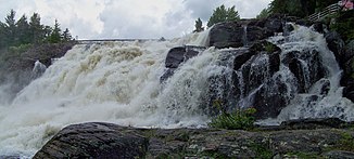
North Branch Muskoka River at the High Falls, north of Bracebridge |
||
| South Branch Muskoka River | ||
| origin |
Lake of Bays 45 ° 10 ′ 23 ″ N , 79 ° 6 ′ 1 ″ W. |
|
| Source height | 315 m | |
| confluence | in Bracebridge with North Branch Muskoka River 45 ° 1 ′ 54 ″ N , 79 ° 18 ′ 50 ″ W
|
|
| length | approx. 40 km | |
Muskoka River is a river in the Canadian province of Ontario .
The actual Muskoka River is created by the confluence of its two headwaters, the North Branch Muskoka River and the South Branch Muskoka River in the small town of Bracebridge . It flows over a distance of 8 km to Lake Muskoka to the west . The outflow of Lake Muskoka, which splits into two arms - Moon River and Musquash River - which both flow into Georgian Bay , was previously assigned to the Muskoka River.
The Muskoka District Municipality extends over the catchment area of this river system, which extends to the Algonquin Provincial Park .
Both source rivers have a number of waterfalls and rapids, the gradient of which has been used by several smaller hydropower plants since the beginning of the 20th century. The northern source river drains Fairy Lake near Huntsville , while the southern source river drains from the Lake of Bays . Both source rivers cover a distance of about 40 km.
Hydropower plants
The following hydropower plants are located on the South Branch Muskoka River: Matthias 2.8 MW, Trethewey Falls 2 MW, Hannah Chute 1 MW, South Falls 5 MW.
Wilson's Falls 0.6 MW and Bracebridge Falls 0.6 MW are also located on the North Branch Muskoka River .
Individual evidence
- ↑ Ontario Power Authority ( Memento of the original from January 4, 2012 in the Internet Archive ) Info: The archive link was inserted automatically and has not yet been checked. Please check the original and archive link according to the instructions and then remove this notice.
- ^ Ontario Power Generation

