
Altberg (Zurich)
| Altberg | ||
|---|---|---|
.JPG) Altberg |
||
| height | 631 m | |
| location | Canton of Zurich , Switzerland | |
| Dominance | 3.81 km → Berg ( Buchs ) | |
| Notch height | 158 m ↓ Bucheggplatz | |
| Coordinates | 674 078 / 254 103 | |
|
||

The Altberg is a range of hills in the canton of Zurich , Switzerland . It rises between the Limmattal in the south and the Furttal in the north. Its height is up to 631 m above sea level. M.
history
It belonged to the catchment area of the village of Alemannen Tano, which later became Dänikon . Tano and his people came to the area much later, when almost all the southern slopes were already occupied by other groups. Therefore, he had to be content with the area north of the Altberg. At least there was meadow and arable land there. The farmers used the three-sided system . They were in the large estates of clergy, nobles and commoners. The owners were primarily the monasteries of Einsiedeln and Wettingen , also the barons of Regensberg .
Already at the end of the 19th century there was a restaurant on the Altberg. There was also a four-story observation tower on the ridge.
On July 10, 2010 the 30 meter high Altberg observation tower was inaugurated, which cost 660,000 Swiss francs .
photos

View from the Burghorn on the Lägern to Dänikon on the north slope of the Altberg

View from Altberg in east direction to Hasleren (583 m above sea level)
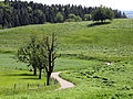
Altberg

View from Altberg in southeast direction


.JPG)
