Old Castle (Laudert)
| Old castle in Laudert | ||
|---|---|---|
|
Alte Burg Laudert photographed from the outer wall from the south-east. In the foreground, the outer ditch filled with water can be seen. |
||
| Alternative name (s): | Alte Burg Laudert, Burg Laudert | |
| Creation time : | not known, probably 11. – 13. century | |
| Castle type : | Niederungsburg, moth | |
| Conservation status: | Burgstall, earthworks | |
| Place: | Laudert | |
| Geographical location | 50 ° 5 '14.2 " N , 7 ° 36' 9.6" E | |
| Height: | 465 m above sea level NN | |
|
|
||
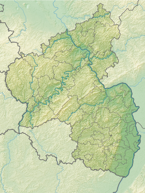
The old castle , also called Burg Laudert , is a defunct tower hill castle (Motte) in the local area of the municipality of Laudert in the Verbandsgemeinde Sankt Goar-Oberwesel in the Rhein-Hunsrück district in Rhineland-Palatinate .
history
The old castle is a moth system that cannot be reliably dated in the headwaters of the Simmerbach near the municipality of Laudert. The castle itself has not yet been clearly identified in the sources.
The place Laudert was first mentioned in 1275 as Ludinroit in a document about the tithe in Laudert and the surrounding villages, which the family of Milwalt held. The Lords of Milwalt owned at least half of the nearby village of Maisborn as an allodial property ; Wepeling Theoderich von Milewald carried half the village in 1330 and in 1333 the jurisdiction of Mensborn Kurtrier as a fief . It is therefore assumed that the old castle is the ancestral castle of this noble family, which Hermann von Milwalt lent to Count Diether V. von Katzenelnbogen in 1262 .
investment
Karl August von Cohausen provided the first description of this system in 1852.
It is an approximately rectangular central hill (approx. 18 × 20 meters at a height of approx. 4–5 meters), the sides of which drop off steeply. In the middle of the hill there is a rectangular excavation that could be the result of a subsequent excavation. This central hill is surrounded by a 6–10 meter wide ditch, which in turn is bounded by an approximately 5 meter wide, 1.25–1.90 meter high wall. This wall forms a rectangle of approx. 50 × 37 meters. On the north side it is widened like a plateau, so that an area of approx. 17 × 39 meters arises, which was possibly used as a bailey . Around this wall there is a second ditch up to 15 meters wide and approx. 2 meters deep , which is bordered by the approx. 1.5 meter high outer wall.
Finds
Perforated slate slabs from a roof or side cover were found on the castle hill. Furthermore, medieval shards (13th / 14th century) could be picked up. (See image)
Folk tales
Cohausen reports that in the vicinity of Laudert it was said that shepherds who had gone to the area on hot summer days saw a box with money and valuables in the moor. However, they did not dare to lift it, because a black dog was lying on top of her and showing her teeth.
literature
- Elmar Rettinger: Historical local dictionary of Rhineland-Palatinate . Volume 2: Former district of St. Goar, keyword Laudert ( PDF ; 36.7 kB).
- Elmar Rettinger: Historical local dictionary of Rhineland-Palatinate . Volume 2: Former district of St. Goar, keyword ALTE BURG Burgruine (Gmk. Laudert) ( PDF ; 19.9 kB).
Web links
Individual evidence
- ^ Adam Goerz: Mittelrheinische Regesten or chronological compilation of the source material for the history of the territories of the two administrative districts of Koblenz and Trier in short excerpts. IV (from the year 1273 to 1300). Koblenz 1886, p. 35 f. # 158 .
- ^ J. Mötsch : The Balduineen. Structure, development and content of the document collection of Archbishop Balduin of Trier . Landesarchivverwaltung Rheinland-Pfalz, Koblenz 1980, ISBN 3-922018-98-X , p. 210 .
- ^ WA Günther : Codex Diplomaticus Rheno-Mosellanus . Volume III - documents of the XIVth century, section 1 - documents from 1300-1350. Koblenz 1824, p. 316, Reg. No. 196 .
- ^ W. Fabricius : The Palatinate Oberamt Simmern . In: West German magazine for history and art . tape 28 , 1909, pp. 88 .
- ↑ KE Demandt: Regesta of the Counts of Katzenelnbogen 1060-1486 . tape 1: 1060-1418 . Self-published by the Historical Commission for Nassau, Wiesbaden 1953, ISBN 3-922244-10-6 , p. Reg. No. 145 .
- ^ A b c Karl August von Cohausen: Old entrenchments on the Hunsrück and their relationship to the fortress Rheinfels near St. Goar . In: Yearbooks of the Society of Friends of Antiquity in the Rhineland . tape XVIII . Bonn 1852, p. 46 ff . ( Full text in Google Book Search).
- ^ Reinhard Friedrich: Settlement studies on a group of castle hills in the Hunsrück . In: Interdisciplinary studies on European castle research, Festschrift for Horst Wolfgang Böhme on his 65th birthday, part 2 . Braubach 2005, ISBN 3-927558-24-9 . ( Publications of the German Castle Association . Series A: Research, Volume 9 , p. 59 f . )


