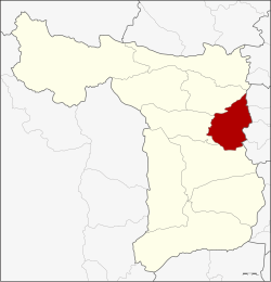
Si Prachan district
|
Si Prachan ศรีประจันต์ |
|
|---|---|
| Province: | Suphan Buri |
| Surface: | 181.0 km² |
| Residents: | 62,419 (2013) |
| Population density : | 359.1 U / km² |
| ZIP : | 72140 |
| Geocode : | 7205 |
| map | |

|
|
Amphoe Si Prachan ( Thai : อำเภอ ศรีประจันต์ , pronunciation: ʔāmpʰɤ̄ː sǐː prā.tɕān ) is a district ( amphoe - administrative district) in the eastern part of the province of Suphan Buri . Suphan Buri is located in the west of the central region of Thailand .
geography
The neighboring amphoe is clockwise from the south: the amphoe Mueang Suphan Buri , Don Chedi and Sam Chuk in the province of Suphan Buri, and the amphoe Sawaeng Ha , Pho Thong , Samko and Wiset Chai Chan in the province of Ang Thong .
The main water resource of Si Prachan is the Mae Nam Tha Chin (Tha Chin River), also called Mae Nam Suphan (Suphan River).
history
In 1901, the government separated some parts of Tha Phi Liang County (now Mueang Suphan Buri District ) and Nang Buat to establish the new Si Prachan County.
administration
Provincial Administration
Si Prachan County is divided into nine tambon ("subdistricts" or "parishes"), which are further subdivided into 64 muban ("villages").
| No. | Surname | Thai | Muban | Pop. |
|---|---|---|---|---|
| 1. | Si Prachan | ศรีประจันต์ | 6th | 8,607 |
| 2. | Ban Krang | บ้าน กร่าง | 6th | 8,334 |
| 3. | Mot Daeng | มดแดง | 7th | 5,412 |
| 4th | Bang Ngam | บาง งาม | 6th | 3,382 |
| 5. | Don Pru | ดอน ป รู | 9 | 9.210 |
| 6th | Plai Na | ปลายนา | 7th | 8,329 |
| 7th | Wang Wa | วัง หว้า | 7th | 5,382 |
| 8th. | Wang Nam Sap | วัง น้ำซับ | 7th | 6,761 |
| 9. | Wang Yang | วัง ยาง | 9 | 7.002 |
Local administration
There are six municipalities with "small town" status ( Thesaban Tambon ) in the district:
- Ban Krang (Thai: เทศบาล ตำบล บ้าน กร่าง ) consisting of parts of the Tambon Ban Krang.
- Wang Wa (Thai: เทศบาล ตำบล วัง หว้า ) consisting of the complete tambon Wang Wa.
- Wang Nam Sap (Thai: เทศบาล ตำบล วัง น้ำซับ ) consisting of the complete tambon Wang Nam Sap.
- Si Prachan (Thai: เทศบาล ตำบล ศรีประจันต์ ) consisting of the parts of the Tambon Si Prachan, Ban Krang.
- Wang Yang (Thai: เทศบาล ตำบล วัง ยาง ) consisting of the complete tambon Wang Yang.
- Plai Na (Thai: เทศบาล ตำบล ปลายนา ) consisting of the complete tambon Plai Na.
There are also four " tambon administration organizations " ( องค์การ บริหาร ส่วน ตำบล - Tambon Administrative Organizations, TAO)
- Si Prachan (Thai: องค์การ บริหาร ส่วน ตำบล ศรีประจันต์ ) consisting of parts of the Tambon Si Prachan.
- Mot Daeng (Thai: องค์การ บริหาร ส่วน ตำบล มดแดง ) consisting of the complete tambon Mot Daeng.
- Bang Ngam (Thai: องค์การ บริหาร ส่วน ตำบล บาง งาม ) consisting of the complete Tambon Bang Ngam.
- Don Pru (Thai: องค์การ บริหาร ส่วน ตำบล ดอน ป รู ) consisting of the complete tambon Don Pru.
Individual evidence
- ↑ 2013 population statistics ( Thai ) Department of Provincial Administration. Retrieved September 20, 2014.
Web links
Coordinates: 14 ° 37 ' N , 100 ° 9' E
