Amphoe Than To
|
Than To ธารโต |
|
|---|---|
| Province: | Yala |
| Surface: | 648.0 km² |
| Residents: | 23,533 (2012) |
| Population density : | 32.9 U / km² |
| ZIP : | 95150, 95130, 95170 |
| Geocode : | 9504 |
| map | |

|
|
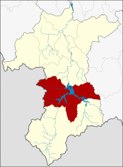
Amphoe Than To ( Thai อำเภอ ธารโต ) is a district ( Amphoe - administrative district) in the south of the province of Yala . The province of Yala is located in the extreme south of the southern region of Thailand on the border with Malaysia .
geography
Neighboring counties and areas are (clockwise from north): Amphoe Bannang Sata in Yala Province, Amphoe Si Sakhon in Narathiwat Province and Amphoe Betong again in Yala. To the west is the state of Kedah of Malaysia .
In Tambon Ban Rae, members of the hunter-gatherer culture of the Semang (subgroups Jahay Tehedeh and Kensiu Lue [Hetot and Batu]) who came from Narathiwat and Kedah settle for a short time .
history
Than To was initially set up as a subdistrict ( King Amphoe ) on June 9, 1975 , by separating Tambon Mae Wat from Bannang Sata district . On July 13, 1981, Than To was given full amphoe status.
administration
Provincial Administration
Amphoe Than To is divided into four subdistricts ( tambon ) , which are further subdivided into 33 village communities ( muban ) .
|
Local administration
Khok Chang ( เทศบาล ตำบล คอกช้าง ) is a small town ( Thesaban Tambon ) in the district, it consists of parts of the Tambon Mae Wat.
There are also four "Tambon Administrative Organizations " ( องค์การ บริหาร ส่วน ตำบล - Tambon Administrative Organizations, TAO) for the Tambon or the parts of Tambon in the county that do not belong to any city.
Web links
- More details on Amphoe Than To from amphoe.com (in Thai)
Individual evidence
- ↑ ประกาศ กระทรวง มหาดไทย เรื่อง แบ่ง ท้องที่ อำเภอ บันนังสตา จังหวัด ยะลา ตั้ง เป็น กิ่ง อำเภอ ธารโต (PDF) Royal Gazette, Volume 92, Ed. 109 ง of June 10, 1975, p. 1412 (in Thai)
- ↑ พระราชกฤษฎีกา ตั้ง อำเภอ หนองใหญ่ อำเภอ บ่อไร่ อำเภอ พรหมคีรี อำเภอ นาบอน อำเภอ บางสะพาน น้อย อำเภอ นาดี อำเภอ กงหรา อำเภอ วังทรายพูน อำเภอ ธารโต อำเภอ คำตากล้า อำเภอ อำเภอ ศรีนคร อำเภอ ด่านช้าง อำเภอ พรเจริญ อำเภอ วังสามหมอ และ อำเภอ ลานสัก พ.ศ. ๒๕๒๔ (PDF) Royal Gazette, Volume 98, Ed. 115 ก Special ( ฉบับ พิเศษ ) of July 13, 1981, pp. 7-10 (in Thai)
- ↑ Population statistics 2012 . Department of Provincial Administration. Retrieved July 15, 2014.
Coordinates: 6 ° 10 ′ N , 101 ° 11 ′ E

