Andahuaylas
| Andahuaylas | ||
|---|---|---|
|
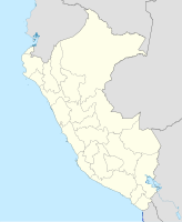
Coordinates: 13 ° 39 ′ S , 73 ° 23 ′ W Andahuaylas on the map of Peru
|
||
| Basic data | ||
| Country | Peru | |
| region | Apurímac | |
| province | Andahuaylas | |
| Residents | 58,416 (2017) | |
| City insignia | ||
| Detailed data | ||
| height | 2926 m | |
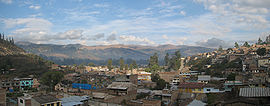
Andahuaylas is a city in Peru with 58,416 inhabitants (as of 2017). The city is located in the valley of the Río Chumbao in the Andean highlands , at an altitude of about 2900 meters. It is an important center of the Apurímac region . The city of Andahuaylas is divided into the three districts of Andahuaylas (the city center), San Jerónimo and Talavera .
Andahuaylas Province
Andahuaylas is the capital of the province of the same name.
The Andahuaylas province is one of the poorest provinces in Peru. The majority of the population is of Indian descent.
Attractions
The city has a remarkable church from the 17th century, which was built on an old Inca ruin.
traffic
The Andahuaylas airport is from the Corporación Peruana de Aeropuertos y Aviación Comercial operated (CORPAC). It was served by the Peruvian airline LC Perú from Lima . Since LC Perú ceased flight operations in November 2018, there are currently no scheduled flights to Andahuaylas.


