
Apurímac region
| Apurímac region | |||
|---|---|---|---|
 .svg) |
|||
| Symbols | |||
|
|||
| Basic data | |||
| Country | Peru | ||
| Capital | Abancay | ||
| surface | 20,895.8 km² | ||
| Residents | 458,800 (2015) | ||
| density | 22 inhabitants per km² | ||
| founding | April 28, 1873 | ||
| ISO 3166-2 | PE-APU | ||
| Website | www.regionapurimac.gob.pe (Spanish) | ||
| politics | |||
| Gobernador regional | Baltazar Lantarón Núñez (2019-2022) | ||
 |
|||


Coordinates: 13 ° 36 ′ S , 73 ° 0 ′ W
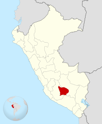
The region Apurímac [ apuˈɾimak ] ( Spanish Región Apurímac , Quechua Apurimaq suyu ) is a region in the Peruvian Andes with 458,800 inhabitants (2015), around 700 kilometers southeast of Lima . At 20,895.79 km², the region is roughly the size of Hesse . The capital of the region is Abancay .
The name Apurímac comes from the name of the Río Apurímac , a source river of the Amazon . Etymologically , the name can be derived from Quechua and means "the Lord who speaks".
geography
The region is very mountainous, with some mountains over 5000 meters and deep valleys. The highest mountain in the region is Ampay at 5223 meters.
The regional capital Abancay has 60,000 inhabitants and is around 180 km west of Cusco . It is the bishopric and houses two hospitals, two universities, the court and a market. Abancay is in the socio-economic sphere of influence of Cusco, while the second largest metropolitan area of Apurímac, Andahuaylas (with the national airport, Andahuaylas Airport ), is more in the sphere of influence of the city of Ayacucho .
The road connections in the region are comparatively poor. But the roads towards Lima and Cusco are paved. In the past, the bus took about 5 hours to Cusco.
population
More than three quarters of the population are indigenous . Apurímac is the region of Peru with the highest proportion of Quechua native speakers (69.7%; variants Chanka and Qusqu-Qullaw ).
history
The region was legally established as a department on April 26, 1873 .
In the 1980s and 1990s, Apurímac was a stronghold of the Maoist Sendero Luminoso (Shining Path).
Provinces
The Apurímac region is divided into seven provinces and 80 districts.
| province | Capital |
|---|---|
| Abancay | Abancay |
| Andahuaylas | Andahuaylas |
| Antabamba | Antabamba |
| Aymaraes | Chalhuanca |
| Chincheros | Chincheros |
| Cotabambas | Tambobamba |
| Gray | Chuquibambilla |
Web links
- http://www.regionapurimac.gob.pe/ Regional government of the Apurímac region
Individual evidence
- ↑ Instituto Nacional de Estadistica e Informatica: 2017 census. Idioma o lengua con el que aprendió hablar. Retrieved September 14, 2018 (Spanish).
Amazon | Ancash | Apurímac | Arequipa | Ayacucho | Cajamarca | Callao | Cusco | Huancavelica | Huánuco | Ica | Junín | La Libertad | Lambayeque | Lima | Loreto | Madre de Dios | Moquegua | Pasco | Piura | Puno | San Martín | Tacna | Tumbes | Ucayali
Lima Province (region-free area of the capital)