Antabamba Province
| Antabamba Province | |||
|---|---|---|---|
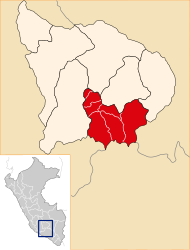
 Location of the province in the Apurímac region |
|||
| Symbols | |||
|
|||
| Basic data | |||
| Country | Peru | ||
| region | Apurímac | ||
| Seat | Antabamba | ||
| surface | 3219 km² | ||
| Residents | 11,310 (2017) | ||
| density | 3.5 inhabitants per km² | ||
| founding | August 20, 1872 | ||
| ISO 3166-2 | PE-APU | ||
| politics | |||
| Alcaldesa Provincial | Rocío Narváez Choquecahuana (2019-2022) |
||
| Political party | El Frente Amplio por Justicia, Vida y Libertad | ||
| Landscape near Huaquirca | |||
Coordinates: 14 ° 28 ′ S , 72 ° 44 ′ W
The province of Antabamba is one of seven provinces in the administrative region of Apurímac in southern Peru . The province extends over an area of 3219 km². The 2017 census counted 11,310 inhabitants in the province of Antabamba. Ten years earlier the population was 12,267. The provincial capital is Antabamba .
Geographical location
The province of Antabamba extends over the mountains north of the Cordillera Huanzo mountain range . The two rivers Río Pachachaca and Río Vilcabamba , which have their source in the mountains and flow into the Río Apurímac , flow through the province in a northerly direction.
The province of Antabamba borders in the north on the province of Grau , in the east on the province of Cotabambas and on the region of Cusco , in the south on the regions Arequipa and Ayacucho and in the west on the province of Aymaraes .
structure
The Antabamba Province consists of 7 districts. The Antabamba district is the seat of the provincial administration.
| District | Administrative headquarters |
|---|---|
| Antabamba | Antabamba |
| El Oro | Ayahuay |
| Huaquirca | Huaquirca |
| Juan Espinoza Medrano | Mollebamba |
| Oropesa | Oropesa |
| Pachaconas | Pachaconas |
| Sabaino | Sabaino |
Web links
- Peru: Region Apurímac (provinces and districts) at www.citypopulation.de
- INEI Perú


