Angels Landing
| Angels Landing | ||
|---|---|---|
|
Angels Landing, seen from the southwest |
||
| height | 1765 m | |
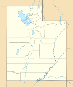
| location | Washington County , Utah , USA | |
| Mountains | Grand Staircase , Colorado Plateau | |
| Coordinates | 37 ° 16 '10 " N , 112 ° 56' 53" W | |
|
|
||
| Type | Rock tower | |
| rock | Sandstone | |
| Age of the rock | Lower Jurassic , approx. 180 million years | |
| particularities | Most climbed mountain in Zion National Park | |
|
The path to the top of Angels Landing |
||
Angels Landing ( English for 'landing place of angels') is the most climbed mountain in Zion National Park . It is a 1765 m high rock formation in a loop ( Big Bend ) of the North Fork of the Virgin River in Zion Canyon . Your summit is (Engl. A round 4.35 km long hiking trail trail ) to reach 450 m height difference and offers spectacular views. The trail was completed in 1926.
Geology and geomorphology
Zion Canyon and Angels Landing are part of the Grand Staircase , which has been formed in the unfolded, predominantly Mesozoic sedimentary rocks of the Colorado Plateau over the past million years . Angels Landing is a thickset rock tower with nearly vertical sidewalls consisting of porous and permeable and relatively weathering - and erosion resistant aeolian quartz sandstone of the Navajo Formation (Upper Jurassic , about 180 million years ago) there. In the significantly more gently sloping slopes at the foot of the mountain, the slightly older (also higher Lower Jurassic) less erosion-resistant silt and clay stones of the Kayenta formation bite out.
Ascent
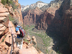
A well-developed and secured hiking trail leads to the summit of Angels Landing for most of the route. However, the ridge to the tip is heavily exposed and secured with a chain. A total of around five hours should be planned for the way there and back. The first three kilometers are paved. Most of the route is usually under strong sunlight. The last section, about one kilometer long, should only be climbed by people who are not afraid of heights. In the event of rain, thunderstorms and strong winds, a warning is issued before entering the trail.
From Angels Landing Viewpoint , you can look almost 500 meters down to the Virgin River as it winds around The Organ , the narrow red rock wall that runs northeast from Angels Landing. Opposite Angels Landing, on the other side of the Virgin River, rise the very striking Great White Throne in the southeast , Cable Mountain in the east and Observation Point in the northeast . The way back is the same route.
Individual evidence
- ^ Section after Helmut H. Doelling: Interim geologic map of the Temple of Sinawava quadrangle, Washington County, 1: 24,000. Open File Report 396th Utah Geological Survey 2002 ( PDF )
- ↑ a b Angels Landing Trail , accessed August 30, 2013.


