Angerbach (Rinnenbach)
| Angerbach | ||
|
Angerbach |
||
| Data | ||
| location | Miesbach district | |
| River system | Danube | |
| Drain over | Rinnenbach → Große Gaißach → Isar → Inn → Danube → Black Sea | |
| source | at Waakirchen 47 ° 46 ′ 46 ″ N , 11 ° 39 ′ 3 ″ E |
|
| Source height | 731 m above sea level NN | |
| muzzle | in the Rinnenbach Coordinates: 47 ° 45 ′ 39 ″ N , 11 ° 39 ′ 21 ″ E 47 ° 45 ′ 39 ″ N , 11 ° 39 ′ 21 ″ E |
|
| Mouth height | 731 m above sea level NN | |
| Height difference | 0 m | |
| Bottom slope | approx. 0 ‰ | |
| length | approx. 3.5 km | |
| Communities | Waakirchen | |
The Angerbach is an Upper Bavarian stream that flows into the Rinnenbach .
course
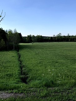
The Angerbach arises in a wooded area northwest of Waakirchen , then flows largely southward in the flat, hilly terrain and is crossed by the B 472 , where another small spring stream flows into it from the left and east, which apparently rises in the center of Waakirchen, where a road (Am Angerbach) is named after him. South of the B 472, the brook forms a swamp that has been designated a natural monument and in this wetland it flows into the Rinnenbach.
Individual evidence
- ↑ Entry in the BayernAtlas . 2020-06-12.
