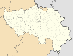
Atzerath
| Atzerath | ||
|---|---|---|
|
|
||
| State : |
|
|
| Region : | Wallonia | |
| Province : | Liege | |
| District : | Verviers | |
| Municipality : | Saint Vith | |
| Coordinates : | 50 ° 17 ' N , 6 ° 13' E | |
| Residents: | 119 pop. | |
| Post Code: | 4783 | |
| Prefix: | 080 | |
| Website: | www.st.vith.be | |
Atzerath is a village in the German-speaking Community in Belgium and part of the municipality of Sankt Vith . The place has 119 inhabitants (information as of December 31, 2015).
Atzerath is located around seven kilometers east of the town center Sankt Vith in the Ourgrund valley , through which the Our flows in the south of the village . Coming from the north, the Treisbach flows into the Our at Atzerath. Schönberg is just under three kilometers to the east .
Together with the other five villages of the Ourgrund, the village belongs to the Mackenbach parish. The parish church of St. Laurentius, built around 1500, with its windows designed by André Blank , is located in the hamlet of Mackenbach on the eastern outskirts of Atzerath. Together with the cemetery wall, the church is a protected cultural monument .
history
Before 1977 Atzerath was administered by the municipality of Lommersweiler . With the Belgian community reform , the new large community of Sankt Vith merged.
economy
The largest employer in town is the wood refiner, Hoffmann AG, which emerged from a sawmill.
Individual evidence
- ↑ residents of the community of ST. VITH per location. (PDF) (No longer available online.) City of St. Vith, December 31, 2015, archived from the original on February 12, 2016 ; accessed on February 12, 2016 . Info: The archive link was inserted automatically and has not yet been checked. Please check the original and archive link according to the instructions and then remove this notice.

