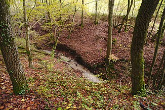
Auersmacher Tiefenbach
| Auersmacher Tiefenbach | ||
| Data | ||
| Water code | DE : 2643134 | |
| location |
Saar-Blies-Gau
|
|
| River system | Rhine | |
| Drain over | Saar → Moselle → Rhine → North Sea | |
| origin | Confluence of two streams north of Auersmacher 49 ° 9 ′ 3 ″ N , 7 ° 3 ′ 10 ″ E |
|
| Source height | approx. 317 m above sea level NHN | |
| muzzle | at Kleinblittersdorf Coordinates: 49 ° 8 '50 " N , 7 ° 2' 29" E 49 ° 8 '50 " N , 7 ° 2' 29" E |
|
| Mouth height | approx. 197 m above sea level NHN | |
| Height difference | approx. 120 m | |
| Bottom slope | approx. 97 ‰ | |
| length | approx. 1.2 km | |
| Catchment area | 1.02 km² | |
| Communities | Auersmacher | |
The Auersmacher Tiefenbach is a good one kilometer long, eastern and right-hand tributary of the Saar . It runs on the border between the two districts of Auersmacher and Kleinblittersdorf in the municipality of the same name.
geography
course
The Tiefenbach is a confluence of two brooks that have the same name. Both streams arise on a hill near Kleinblittersdorf.
Shortly after the confluence, the stream flows through the Tiefenbachklamm , which is followed by a hiking trail.
It then leads past the border of the populated area of Auersmacher, underflows the B 51 and then the tracks of the Saarbahn and finally flows out at an altitude of about 197 m above sea level. NHN from the right into the Saar approaching from the south.
Its 1.2 km long run ends about 120 meters below its source, so it has an average bed gradient of 97 ‰.
Catchment area
The 1.02 km² catchment area of the Auersmacher Tiefenbach lies in the Saar-Blies-Gau and in the Middle Saar Valley . It is drained to the North Sea via the Saar, Moselle and Rhine .
It borders
- in the northeast on the the fracture Erbach , in the assemblies leads
- in the southeast to that of the Blies itself, which flows into the Saar
- in the northwest to the gorge of the Saar tributary
- and in the north to that of the Scheerbach , also a tributary of the Saar.
Drinking water
There are three boreholes on the Auersmacher Tiefenbach. These holes are 140, 256 and 365 meters deep, respectively. The water drawn from there is treated in the Auersmacher waterworks and supplies the districts of Auersmacher, Sitterswald and Rilchingen-Hanweiler with drinking water.
Individual evidence
- ↑ a b c d GeoPortal Saarland
- ↑ Source height of the left source branch
- ↑ Eike Dubois: The Blies-Grenz-Weg. Retrieved November 11, 2019 .
- ↑ Heiko Lehmann: Kleinblittersdorf has the finest water. Saarbrücker Zeitung , March 22, 2018, accessed on November 11, 2019 .
