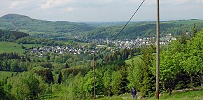
Kohlhaukuppe
| Kohlhaukuppe | ||
|---|---|---|
|
Evening mood at the Kohlhaukuppe |
||
| height | 785.9 m above sea level NHN | |
| location | District of Saxon Switzerland-Eastern Ore Mountains , Saxony ( Germany ) | |
| Mountains | Ore Mountains | |
| Coordinates | 50 ° 44 '38 " N , 13 ° 47' 35" E | |
|
|
||
| rock | Granite porphyry | |
| particularities | Observation tower | |
The Kohlhaukuppe is 785.9 m above sea level. NHN high mountain in the Eastern Ore Mountains south of Geising in the Saxon district of Saxon Switzerland-Eastern Ore Mountains not far from the border with the Czech Republic . There is a mountain hut and a lookout tower on its summit .
history
In older archives the mountain is only called Kuppe or Koppe. When the 800th anniversary of the Wettin House was celebrated in 1889 and numerous celebrations took place in the Kingdom of Saxony , the mountain was renamed Wettinhöhe and a nine-meter-high iron observation tower was built on the summit. Its inauguration took place on June 16, 1889.
Next to the tower, an arbor-like wooden structure was built as a small restaurant. The mountain hut was only open in summer. After cultivation on the mountain came to a complete standstill in the First World War, a new building with a massive cellar was built after the end of the war, which existed until 1933. In that year the mine was demolished on the instructions of a customs commissioner because, among other things, pamphlets had been illegally distributed here.
After the Second World War, the name Wettinhöhe was deleted and the mountain was given its current name. Reconstruction of the building began in 1952, while the tower was raised by two meters. This tower stood until 1995, when it was replaced with a steel structure similar to the original tower.
The Bergbaude has been open again since 1993. There are building evenings with "sagas and magic". Because of the garlic dishes on offer there, the mountain is popularly known as the "garlic dome".
Paths to the summit
There is no driveway for cars. A chargeable parking lot is available at the Hüttenteich in Geising. From there, two well-marked hiking trails run to the summit: either on the driveway or a steeper, but shorter variant up the Anton-Günther-Stein.
view
- In the north: Geising , on the left the Geisingberg , on the right the Wilisch
- To the east: the Spitzberg , right: Hoher Schneeberg
- In the southwest: Zinnwald
- In the northwest: Altenberg
- In the southeast: Vorderzinnwald , behind the Komáří hůrka on the Bohemian side.
Web links
Individual evidence
- ↑ a b Saxony Atlas of the Free State of Saxony ( notes )


