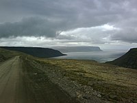
Bíldudalsvegur
| Main Road 63 Iceland |
|||||||||||||||||||||||||||||||||||||||||||||||||||||||||||||||||||||||||||||||||||||||||||
| Bíldudalsvegur | |||||||||||||||||||||||||||||||||||||||||||||||||||||||||||||||||||||||||||||||||||||||||||

|
|||||||||||||||||||||||||||||||||||||||||||||||||||||||||||||||||||||||||||||||||||||||||||
| map | |||||||||||||||||||||||||||||||||||||||||||||||||||||||||||||||||||||||||||||||||||||||||||
| Basic data | |||||||||||||||||||||||||||||||||||||||||||||||||||||||||||||||||||||||||||||||||||||||||||
| Operator: | Vegagerðin | ||||||||||||||||||||||||||||||||||||||||||||||||||||||||||||||||||||||||||||||||||||||||||
| Start of the street: |
Barðastrandarvegur ( 65 ° 36 ′ N , 23 ° 58 ′ W ) |
||||||||||||||||||||||||||||||||||||||||||||||||||||||||||||||||||||||||||||||||||||||||||
| End of street: |
Vestfjarðavegur ( 65 ° 38 ′ N , 23 ° 15 ′ W ) |
||||||||||||||||||||||||||||||||||||||||||||||||||||||||||||||||||||||||||||||||||||||||||
| Overall length: | 62.94 km | ||||||||||||||||||||||||||||||||||||||||||||||||||||||||||||||||||||||||||||||||||||||||||
| Road 63, Trostansfjörður | |||||||||||||||||||||||||||||||||||||||||||||||||||||||||||||||||||||||||||||||||||||||||||
|
Course of the road
|
|||||||||||||||||||||||||||||||||||||||||||||||||||||||||||||||||||||||||||||||||||||||||||
The Bíldudalsvegur is a main road in the West Fjords of Iceland . It begins in Patreksfjörður and leads north to Vestfjarðavegur ![]() in the direction of Ísafjörður .
in the direction of Ísafjörður .
Where the Barðastrandarvegur ![]() turns to the southwest into the town of Patreksfjörður , the Bíldudalsvegur leads east through the Miklidalur. With a gradient of up to 12%, it reaches a height of 369 m. The road then leads through Höfðadalur into inner Tálknafjörður . Lambeyrarvegur 6181 opens up its southern bank for 5.37 km. Opposite is the place Tálknafjörður on Tálknafjarðarvegur
turns to the southwest into the town of Patreksfjörður , the Bíldudalsvegur leads east through the Miklidalur. With a gradient of up to 12%, it reaches a height of 369 m. The road then leads through Höfðadalur into inner Tálknafjörður . Lambeyrarvegur 6181 opens up its southern bank for 5.37 km. Opposite is the place Tálknafjörður on Tálknafjarðarvegur ![]() , which opens up the north bank with a total length of 10.09 km. The Bíldudalsvegur rises to the Hálfdan up to an altitude of 500 km, and then in the Bíldudalsvogur bay it reaches about sea level again. The Ketildalavegur branches off here
, which opens up the north bank with a total length of 10.09 km. The Bíldudalsvegur rises to the Hálfdan up to an altitude of 500 km, and then in the Bíldudalsvogur bay it reaches about sea level again. The Ketildalavegur branches off here ![]() and continues through the village of Bíldudalur to Selárdalur (total length 25.20 km). In town it is first called Dalbraut, later Tjarnarbraut. The Bíldudalsvegur is paved as far as the Bíldudalur airfield in Fossfjörður . The further course does not yet have a solid road surface. It leads around the entire Fossfjörður and Reykjarfjörður . After reaching the inner Trostansfjörður , it leaves the coast and climbs up denveradalsskarð, where after 63 km it meets Vestfjarðavegur
and continues through the village of Bíldudalur to Selárdalur (total length 25.20 km). In town it is first called Dalbraut, later Tjarnarbraut. The Bíldudalsvegur is paved as far as the Bíldudalur airfield in Fossfjörður . The further course does not yet have a solid road surface. It leads around the entire Fossfjörður and Reykjarfjörður . After reaching the inner Trostansfjörður , it leaves the coast and climbs up denveradalsskarð, where after 63 km it meets Vestfjarðavegur ![]() .
.
See also
Web links
- Miklidalur weather and traffic
- Miklidalur webcam facing south-west
- Miklidalur webcam to the northeast
- Hálfdán weather and traffic
- Hálfdán webcam facing south-west
- Hálfdán webcam facing northeast
Individual evidence
- ↑ a b c d Vegaskrá 2018 - kaflaskipt. Retrieved December 29, 2019 (Icelandic).
- ↑ a b c d e f g h Brúaskrá - Brýr á þjóðvegum (February 2016). Retrieved December 20, 2019 (Icelandic).
- ↑ a b Hæð nokkurra vega yfir sjó 22.12.2010. Retrieved December 30, 2019 (Icelandic).
- ↑ Bundið slitlag í árslok 2018. Accessed December 31, 2019 (Icelandic).

