Břehyňský potok
|
Břehyňský potok mill stream |
||
|
Alluvial forest at Břehyňský potok |
||
| Data | ||
| Water code | CZ : 1-14-03-066 | |
| location | Czech Republic | |
| River system | Elbe | |
| Drain over | Robečský potok → Ploučnice → Elbe → North Sea | |
| source | southeast of the Strážov desert on Zlatý vrch, Kummergebirge 50 ° 34 ′ 30 ″ N , 14 ° 45 ′ 0 ″ E |
|
| Source height | 277 m nm | |
| muzzle | in Máchovo jezero in Robečský potok Coordinates: 50 ° 34 ′ 31 ″ N , 14 ° 40 ′ 10 ″ E 50 ° 34 ′ 31 ″ N , 14 ° 40 ′ 10 ″ E |
|
| Mouth height | 266 m nm | |
| Height difference | 11 m | |
| Bottom slope | 1.2 ‰ | |
| length | 9.2 km | |
| Catchment area | 33.47 km² | |
| Drain |
MQ |
100 l / s |
| Reservoirs flowed through | Břehyňský rybník | |
The Břehyňský potok (German Mühlbach ) is a right tributary of the Robečský potok in the Czech Republic .
course
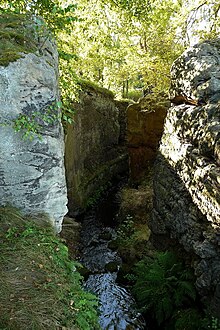
The Břehyňský potok rises southeast of the Strážov desert in the area of the town of Ralsko in the Kummer Mountains ; its source is northeast of the Zlatý vrch (324 m) in the bog Černý močál. The brook initially flows at the foot of Dubová hora ( Eichelberg , 321 m) in a north-westerly direction through the bottom Chmelný důl and changes its direction at Bílý kámen ( Weißenstein , 317 m) to the west. At the foot of the Mlýnský vrch ( Mühlberg , 389 m) the brook near Břehyně is dammed in the pond Břehyňský rybník ( heather pond ). The water drains off via a swallow cut through the sandstone bedrock ( Břehyňská průrva ). The strongly meandering lower course of the Břehyňský potok leads northeast of Doksy past the one-layer cow bridge through alluvial forest to Máchovo jezero . After nine kilometers, the Břehyňský potok flows north of the Bílý kámen (308 m) in the Břehyňská zátoka bay into the Máchovo jezero and thus into the Robečský potok .
The Břehyňský potok flows on its entire course with a slight gradient through wetlands below sandstone rocks. The middle course and most of its upper course are part of the National Nature Reserve NPR Břehyně-Pecopala . The confluence of the Břehyňský potok in the Máchovo jezero is protected as a National Natural Monument NPP Swamp .
Occasionally the Břehyňský potok is regarded as the upper reaches of the Robečský potok, whereby the source of the Bělokamenná strouha in the wetland Pustý rybník ( desert pond ) north of the Bílý kámen (317 m) is given. Other sources see the Dokský potok and Břehyňský potok as equivalent source streams, which unite in the Máchovo jezero to the Robečský potok, which therefore would have a length of only 15.8 kilometers.
history
According to some sources, the heather pond is said to have been created as early as 1287. The pond was probably created sometime between 1366 and 1460. In a privilege granted by Georg von Podiebrad to the town of Hirschberg in 1460, the pond by the Rohlevka brook was first mentioned in writing. The name Rolívka can be found in the Hirschberg town books from 1620 to 1639 . Until 1739 the brook was also marked Roliwka on German-language maps . Then the name Mühlbach / Mlýnský potok prevailed. The current name Břehyňský potok was formed in the 1920s when the Czech place name Břehyně for Heidemühl was created.
Tributaries
- Bělokamenná strouha (r), on Bílý kámen (317 m)
- Jordán (l), at Doksy
Ponds
- Břehyňský rybník, near Břehyně

