Robečský potok
|
Robečský potok Robitz brook, Robitz brook, Neuschlosser brook |
||
|
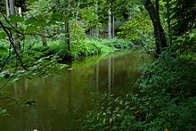
Upper course at Obora |
||
| Data | ||
| Water code | CZ : 1-14-03-063 | |
| location | Czech Republic | |
| River system | Elbe | |
| Drain over | Ploučnice → Elbe → North Sea | |
| source | south of Okna in the Ralská pahorkatina 50 ° 31 ′ 14 ″ N , 14 ° 40 ′ 42 ″ E |
|
| Source height | 285 m nm | |
| muzzle | near Robeč in the Ploučnice coordinates: 50 ° 40 ′ 24 ″ N , 14 ° 29 ′ 58 ″ E 50 ° 40 ′ 24 ″ N , 14 ° 29 ′ 58 ″ E |
|
| Mouth height | 241 m nm | |
| Height difference | 44 m | |
| Bottom slope | 1.7 ‰ | |
| length | 25.2 km | |
| Catchment area | 286.5 km² | |
| Drain |
MQ |
1.65 m³ / s |
| Left tributaries | Bobří potok | |
| Right tributaries | Břehyňský potok | |
| Reservoirs flowed through | Máchovo jezero , Novozámecký rybník | |
| Small towns | Doksy | |
The Robečský potok (German Robitzer Bach , also Robitzbach or Neuschlosser Bach ) is a left tributary of the Ploučnice in the Czech Republic .
course
The Robečský potok rises south of Okna in the Dokeská pahorkatina ( Hirschberg hill country ) belonging to the Ralská pahorkatina ( Rollberg hill country ) and is also called Okenský potok on its upper reaches . The stream initially flows north across the wide plain between the Bösigen and the Tachovský vrch ( Tachner Berg , 445 m) through Okna, Obora and Poslův Mlýn. In Doksy , where the brook Dokský potok or Dokeský potok is called, it takes a north-westerly direction and is dammed at the Kummergebirge near Staré Splavy in the Máchovo jezero .
Below the Máchovo jezero, the Robečský potok is also known as the Mlýnský potok on its middle course . This section leads through a wide and swampy valley that has been protected around the Konvalinkový vrch (290 m) since 2012 on an area of 38.8 hectares as a National Natural Monument NPP Jestřebské slatiny . Downstream of the Robečský potok are the places Sluneční Dvůr, Provodín and Jestřebí . On the left side above the valley in Jestřebí rises the broken sandstone cliff with the remains of the Jestřebí castle . Below Jestřebí, the Robečský potok flows into the largely marshy Novozámecký rybník ( Hirnsener Large Pond ), where the places U Cihelny, Karasy and U Staré Pošty are located. The drain of the pond, which since 1933 part of the 357 hectare National Natural Monument NPP Novozámecký rybník , the 175 m long channel forms Novozámecká průrva ( brain Sener swallowing ).
The lower reaches of the Robečský potok leads past Zahrádky , the Nový Zámek Castle and Karba through the deep rock valley Peklo ( Hell's Ground or Karben Gorge ), which has been protected as a national natural monument below Karba since 1967 on an area of 67 hectares. On both sides of the gorge are the places Krby, Nový Dvůr, Lisova Samota, Kvítkov , Hanelova Samota, Sosnová and Dvůr Robeč as well as the remains of the rock castles Frýdlant and Zahrádky. The Robečský potok then reaches the Ploučnice valley and flows through Robeč. There the brook flows into the Ploučnice after 25.2 kilometers.
The Bakov nad Jizerou – Ebersbach railway runs through the Robečský potok valley .
Occasionally the shorter Břehyňský potok is seen as the upper reaches of the Robečský potok and the Dokský potok as its tributary. Other sources see the Dokský potok and Břehyňský potok as equivalent source streams, which unite in the Máchovo jezero to the Robečský potok, which therefore would have a length of only 15.8 kilometers.
Tributaries
- Zbynská strouha (l), in Poselský rybník
- Břehyňský potok (r), in Máchovo jezero
- Jestřebský potok or Liboška (l), in Jestřebí
- Bobří potok (l), through Mnichovská průrva in Novozámecký rybník
Ponds
- Velká Pateřinka and Malá Pateřinka, in Obora
- Poselský rybník, between Obora and Poslův Mlýn
- Čepelský rybník, in Doksy
- Máchovo jezero , between Doksy and Staré Splavy
- Novozámecký rybník, between Jestřebí and Zahrádky
- Horní Pekelský rybník and Dolní Pekelský rybník, above Robeč


