Provodín
| Provodín | ||||
|---|---|---|---|---|
|
||||
| Basic data | ||||
| State : |
|
|||
| Region : | Liberecký kraj | |||
| District : | Česká Lípa | |||
| Area : | 1258.8854 ha | |||
| Geographic location : | 50 ° 37 ' N , 14 ° 36' E | |||
| Height: | 263 m nm | |||
| Residents : | 753 (Jan. 1, 2019) | |||
| Postal code : | 471 67 | |||
| License plate : | L. | |||
| traffic | ||||
| Railway connection: | Bakov – Jedlová | |||
| structure | ||||
| Status: | local community | |||
| Districts: | 2 | |||
| administration | ||||
| Mayor : | František Perun | |||
| Address: | Provodín 80 471 67 Provodín |
|||
| Municipality number: | 561983 | |||
| Website : | www.obec-provodin.cz | |||
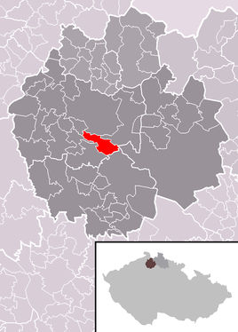
| Location of Provodín in the Česká Lípa district | ||||

|
||||
Provodín (German Mickenhan ) is a municipality in the Okres Česká Lípa in the Liberec region in the north of the Czech Republic . It lies on the right side of the Robečský creek .
history
The place was first mentioned in a document in 1376. From the middle of the 19th century, the municipality belonged to the judicial district of Bohemian Leipa or the district of Bohemian Leipa .
Community structure
The municipality of Provodín consists of the districts Provodín (Mickenhan) and Srní u České Lípy (Rehdörfel) , which also form cadastral districts.
Web links
Commons : Provodín - collection of images, videos and audio files

