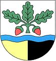
Dubnice pod Ralskem
| Dubnice | ||||
|---|---|---|---|---|
|
||||
| Basic data | ||||
| State : |
|
|||
| Region : | Liberecký kraj | |||
| District : | Česká Lípa | |||
| Area : | 1582.7167 ha | |||
| Geographic location : | 50 ° 44 ' N , 14 ° 49' E | |||
| Height: | 313 m nm | |||
| Residents : | 644 (Jan. 1, 2019) | |||
| Postal code : | 471 26 | |||
| License plate : | L. | |||
| structure | ||||
| Status: | local community | |||
| Districts: | 1 | |||
| administration | ||||
| Mayor : | Otakar Vítek (as of 2007) | |||
| Address: | Dubnice 240 471 26 Dubnice pod Ralskem |
|||
| Municipality number: | 561541 | |||
| Website : | sweb.cz/dubnice | |||
| Location of Dubnice in the Česká Lípa district | ||||

|
||||
Dubnice (German Hennersdorf ) is a municipality of the Okres Česká Lípa in the Liberec region in the north of the Czech Republic and on the southern slope of the Lusatian Mountains . It is located on the road from Jablonné v Podještědí (German fork) to Stráž pod Ralskem (Wartenberg) . East of the village is the valley of the Ještědský potok ( Jeschkenbach ).
history
Dubnicze was first mentioned in 1352. Heinrichsdorf alias Dubnicz , as the place was called in 1405, belonged to the Wartenberg domain. In 1504 Bartholomäus Hirschperger von Königshain acquired the property. His descendants, the brothers Balthasar and Erasmus, were expropriated as Protestants after the battle of the White Mountain ; Albrecht von Waldstein received their goods and sold them to the Liechtensteiners in 1627.
The church was built between 1699 and 1702; Hennersdorf was a pastor since 1700.
In 1981 Dubnice was incorporated into Stráž pod Ralskem , and since 1990 it has been an independent municipality again.
Personalities
- Hans Jaksch (1879–1970), Austrian architect
Individual evidence
- ↑ http://www.uir.cz/obec/561541/Dubnice
- ↑ Český statistický úřad - The population of the Czech municipalities as of January 1, 2019 (PDF; 7.4 MiB)

