
Kravaře v Čechách
| Kravaře | |||||
|---|---|---|---|---|---|
|
|||||
| Basic data | |||||
| State : |
|
||||
| Region : | Liberecký kraj | ||||
| District : | Česká Lípa | ||||
| Area : | 1576.7681 ha | ||||
| Geographic location : | 50 ° 38 ' N , 14 ° 24' E | ||||
| Height: | 280 m nm | ||||
| Residents : | 780 (Jan. 1, 2019) | ||||
| Postal code : | 471 03 | ||||
| License plate : | L. | ||||
| traffic | |||||
| Railway connection: | Řetenice – Lovosice – Česká Lípa – Liberec | ||||
| structure | |||||
| Status: | local community | ||||
| Districts: | 6th | ||||
| administration | |||||
| Mayor : | Vít Vomáčka (as of 2009) | ||||
| Address: | náměstí Míru 166 471 03 Kravaře |
||||
| Municipality number: | 561720 | ||||
| Website : | www.kravarecl.cz | ||||
| Location of Kravaře in the Česká Lípa district | |||||

|
|||||


Kravaře (German Graber ) is a municipality of the Okres Česká Lípa in the Liberec region in the Czech Republic .
Geographical location

The city is located in northern Bohemia in the Bohemian Central Uplands in the valley of the Bobří potok ( Bieberbach ), west of Stvolínky ( Drum ). About a kilometer northwest of the city is the Keffelberg, an extension of the ridge of the low mountain range, which extends from the Zinkenstein ( Buková hora ) in an easterly direction.
history

The very old place burned down completely on March 6, 1646 and later again partially after the reconstruction, whereby most of the documents were lost. The parish church of the Birth of Mary , which had its own pastor as early as 1384, was completely destroyed in the fire of 1646, but was restored soon afterwards. Older forms of the place name are Grabern , Kraber , Grabow , Krawar and Radaussow .
After the First World War , the town of Graber, which had a predominantly German-Bohemian population, was added to the newly created Czechoslovakia . As a result of the Munich Agreement Graber belonged 1938-1945 to district Litomerice , Region of Usti nad Labem , in the Reich District of Sudetenland the German Reich .
After the end of World War II, the entire German population almost bohemian was from Graber sold .
Demographics
| year | Residents | Remarks |
|---|---|---|
| 1830 | 965 | in 175 houses |
| 1930 | 932 | |
| 1939 | 861 |
Community structure
The municipality of Kravaře consists of the districts Janovice (Johnsdorf) , Kravaře (Graber) , Rané (Morgendorf) , Sezímky (Zossnitz) , Veliká (Grossendorf) and Víska (Dörfel) . Basic settlement units are Janovice, Kravaře, Rané and Sezímky.
The municipality is divided into the cadastral districts Janovice u Kravař, Kravaře v Čechách and Rané.

railway station

Marketplace

Former parish hall, village art museum
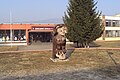
school-building

Parish Church of the Birth of Mary
.jpg)
.jpg)


Attractions
- The community owns a mighty timbered former community hall in the district of Víska . There is an exhibition of village art as a branch of the main regional museum of Česká Lípa , which can be visited independently or with a guide.
- There are brick row houses in the village, mostly built in the Empire style, which were built after the town fire of 1860.
- The place has a church of the born Virgin Mary of the early baroque from 1650. It was rebuilt from 1744 to 1749, the upper part of the tower dates from 1868.
- In the village there is a baroque column from 1708.
sons and daughters of the town
- Joseph May († 1820), educator, 1792–1819 director of the Deaf-Mute Institute in Vienna and author of a textbook for the deaf-mute
- Kurt Krolop (born May 25, 1930 in Kravaře v Čechách (Graber); † March 22, 2016 in Prague) was a German German philologist and literary historian who taught in Prague for a long time
literature
- Turisticka Mapa České středohoří východ, Club Českych Turistu, 3rd edition 2001
Web links
Individual evidence
- ↑ http://www.uir.cz/obec/561720/Kravare
- ↑ Český statistický úřad - The population of the Czech municipalities as of January 1, 2019 (PDF; 7.4 MiB)
- ↑ a b c Johann Gottfried Sommer : The Kingdom of Bohemia . Volume 1: Leitmeritzer Kreis , Prague 1833, p. 329, item 2).
- ↑ Yearbooks of the Bohemian Museum of Natural and Regional Studies, History, Art and Literature . Volume 2, Prague 1831, p. 198, point 5).
- ↑ a b Michael Rademacher: German administrative history from the unification of the empire in 1871 to the reunification in 1990. Leitmeritz district. (Online material for the dissertation, Osnabrück 2006).
- ↑ http://www.uir.cz/casti-obce-obec/561720/Obec-Kravare
- ↑ http://www.uir.cz/zsj-obec/561720/Obec-Kravare
- ↑ http://www.uir.cz/katastralni-uzemi-obec/561720/Obec-Kravare