Brniště
| Brniště | ||||
|---|---|---|---|---|
|
||||
| Basic data | ||||
| State : |
|
|||
| Region : | Liberecký kraj | |||
| District : | Česká Lípa | |||
| Area : | 2671.6339 ha | |||
| Geographic location : | 50 ° 43 ' N , 14 ° 43' E | |||
| Height: | 290 m nm | |||
| Residents : | 1,339 (Jan 1, 2019) | |||
| Postal code : | 471 29 - 471 30 | |||
| License plate : | L. | |||
| traffic | ||||
| Railway connection: | Řetenice – Lovosice – Česká Lípa – Liberec | |||
| structure | ||||
| Status: | local community | |||
| Districts: | 6th | |||
| administration | ||||
| Mayor : | František Jandera (as of 2007) | |||
| Address: | Brniště 102 471 29 Brniště |
|||
| Municipality number: | 561444 | |||
| Website : | www.brniste.cz | |||
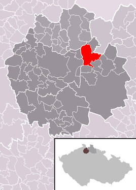
| Location of Brniště in the Česká Lípa district | ||||

|
||||
Brniště (German Brims ) is a municipality of the Okres Česká Lípa in the Liberec region in the north of the Czech Republic on the southern slope of the Lusatian Mountains . It is located about 13 kilometers northeast of Česká Lípa (Bohemian Leipa) and is dominated by the 591 m high Tlustec ( Tölzberg ).
history
The settlement was first mentioned in 1352. At the end of the 18th century a stone bridge was built over the Panenský potok (Jungfernbach) . In the northern part of the village there is a protected linden tree with a trunk circumference of six meters.
Community structure
The municipality of Brniště consists of the districts Brniště (Brims) , Hlemýždí (Schneckendorf) , Jáchymov (Joachimsdorf) , Luhov (Luh) , Nový Luhov (Neuluh) and Velký Grunov (Groß Grünau) .
The municipality is divided into the cadastral districts of Brniště, Hlemýždí, Luhov u Mimoně and Velký Grunov.


