Chlum u Dubé
| Chlum | ||||
|---|---|---|---|---|
|
||||
| Basic data | ||||
| State : |
|
|||
| Region : | Liberecký kraj | |||
| District : | Česká Lípa | |||
| Area : | 1517.1154 ha | |||
| Geographic location : | 50 ° 35 ' N , 14 ° 34' E | |||
| Height: | 332 m nm | |||
| Residents : | 247 (Jan. 1, 2019) | |||
| Postal code : | 471 41 - 471 61 | |||
| License plate : | L. | |||
| structure | ||||
| Status: | local community | |||
| Districts: | 4th | |||
| administration | ||||
| Mayor : | Josef Vítek (as of 2007) | |||
| Address: | Chlum 95 472 01 Doksy |
|||
| Municipality number: | 561614 | |||
| Website : | www.ou-chlum.cz | |||
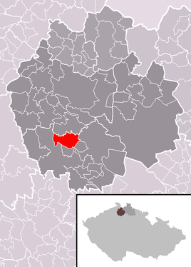
| Location of Chlum in the Česká Lípa district | ||||

|
||||
Chlum (German Klum ) is a municipality in the Okres Česká Lípa in the Liberec region in the north of the Czech Republic .
The farming village is located 5 km northeast of Dubá (Dauba) on the plateau between Daubaer Schweiz and the Kummergebirge . The stream Švábský potok has its source in Chlum, to the northeast the 515 m high Maršovicky vrch (Maschwitz Mountain) rises as a local mountain .
history
Chlum was first mentioned in a document in 1293. The castle researcher Friedrich Bernau assumed that Chlum was formed in the 11th century. At the founding of the city Bezděz (Schloßbösig) you spoke in 1264 Premysl Otakar II. , A village Chlum including the surrounding forests. However, it could not be proven with certainty that it was this place, as the locality Chlum (elongated hill) was a very frequent Slavic name for places and hills.
Wenceslaus II handed the village over to his chamberlain, Hynko von Dubá . Around 1405 Chlum became part of the Habstein rule . The place came to Christoph von Wartenberg via the Smiřický von Smiřice family in 1478 . The Nový Berštejn estate was founded under the Wartenbergs , to which Chlum belonged until the patrimonial rule was replaced in 1848.
There used to be a parish church in the village, which went out during the Hussite Wars . In 1739 a new church was built as a branch church of Pablowitz, which became famous for its extremely valuable monstrance . In 1912 the place had 111 houses.
The legends of the wild rider and the devil's pond have been handed down in Chlum.
Community structure
The municipality of Chlum consists of the districts Chlum ( Klum ), Drchlava (Dürchel) , Hradiště (Radisch) and Maršovice (Maschwitz) . Basic settlement units are Drchlava, Chlum and Maršovice.
The municipality is divided into the cadastral districts of Drchlava, Chlum u Dubé and Maršovice u Dubé.
Attractions
St. George's Church in Chlum has lost its historic furnishings . The organ was expanded in 1968 and moved to Dolná Štubňa near Turčianske Teplice . The main altar from 1670, the side altars and the figures of St. Wenceslas and St. Florian from the 18th century were last described in the 1960s. Within 40 years, the entire equipment of the church was destroyed. Various preserved parts were secured and in 2003 an interim altar was erected.
Sons and daughters of the place
- Ernst Bahr (* 1945), German politician
Individual evidence
- ↑ http://www.uir.cz/obec/561614/Chlum
- ↑ Český statistický úřad - The population of the Czech municipalities as of January 1, 2019 (PDF; 7.4 MiB)
- ↑ http://www.uir.cz/casti-obce-obec/561614/Obec-Chlum
- ↑ http://www.uir.cz/zsj-obec/561614/Obec-Chlum
- ↑ http://www.uir.cz/katastralni-uzemi-obec/561614/Obec-Chlum

