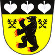
Ralsko
| Ralsko | ||||
|---|---|---|---|---|
|
||||
| Basic data | ||||
| State : |
|
|||
| Region : | Liberecký kraj | |||
| District : | Česká Lípa | |||
| Area : | 17023.4997 ha | |||
| Geographic location : | 50 ° 37 ' N , 14 ° 47' E | |||
| Height: | 331 m nm | |||
| Residents : | 2,117 (Jan 1, 2019) | |||
| Postal code : | 471 24 | |||
| License plate : | L. | |||
| structure | ||||
| Status: | city | |||
| Districts: | 9 | |||
| administration | ||||
| Mayor : | Jindřich Šolc (as of 2007) | |||
| Address: | Kuřívody 701 471 24 Ralsko |
|||
| Municipality number: | 562017 | |||
| Website : | www.mestoralsko.cz | |||
| Location of Ralsko in the Česká Lípa district | ||||

|
||||
Ralsko is a town in the Okres Česká Lípa in the Liberec region in the north of the Czech Republic . It is located south of the Ralsko (Roll) mountain and, at 171 km², is the second largest municipality in the country after Prague. The municipality was established on January 1, 1992 after the Ralsko military training area was closed and includes all of the inhabited settlements on the former military training area. The seat of the city administration is in Kuřívody (chicken water) .
history
Ralsko was once owned by the Berka von Dubá family . The center of the rule was the town of Kuřívody on the trade route from Zittau to Prague . On June 26th (according to other information on June 27th) 1866 the first confrontation between Prussians and Austrians took place here in the German War with the battle near Hühnerwasser .
Although the area suffers from a lack of water, it has been settled since the Middle Ages. The oldest written evidence comes from the second half of the 13th century. A total of about 30 settlements are proven, around 1910 7000 people lived here. Until 1945, the villages were almost exclusively inhabited by Germans. After the expulsion of the German population, Czech settlers came to the abandoned places.
As early as 1947, the area around Kuřívody was cleared again, the villages were largely leveled and the 25,000 hectare Ralsko military training area was set up for the Czechoslovak army . After the Prague Spring 1968, the Soviet Army used the site until 1991. A runway was built near Hradčany for the Soviet space shuttle Buran , which was to serve as a replacement for the Baikonur spaceport in bad weather .
After the Soviets withdrew in 1991, today's parish was established on January 1, 1992. It had only 600 inhabitants when it was founded and was divided into the six districts of Boreček, Dolní Krupá ( Nieder Krupai 2nd part ), Hradčany, Kuřívody, Náhlov and Ploužnice. From the Ukrainian villages of Mala Subiwschtschyna ( Malá Zubovština ) in the Korosten district and Malyniwka ( Malinovka ) in the Malyn district, which were affected by the Chernobyl reactor accident , about 200 Volhynian Czechs were settled here. Since December 1, 2006 the place has city rights.
On July 14, 2010, the city council decided to reorganize the city area. The new districts of Hvězdov and Svébořice were spun off from the district of Ploužnice, and the new district of Jappenček from the district of Kuřívody. The district Dolní Krupá was renamed Horní Krupá. The basic settlement unit Hradčany-sídliště was reclassified from the district Hradčany to the district Ploužnice.
City structure
The town consists of the districts Boreček (Haide Dörfel) , Horní Krupá (Upper Krupai) , Hradčany (Kummer) , Hvězdov (Höflitz) , Jabloneček ( Jablonec ), Kuřívody (Hühnerwasser) , Náhlov (Nahlau) , Ploužnice (Plauschnitz) and Svébořice ( Schwabitz) . Basic settlement units are Boreček, Horní Krupá, Hradčany, Hradčany-sídliště, Hvězdov, Jappenček, Kuřívody, Náhlov, Ploužnice and Svébořice. In the corridors of Ralsko are u. a. the Rotte Skelná Huť (glassworks) and the deserts of Chlum, Dolní Okna ( Heide ), Horní Krupá (Ober Krupai) , Jezová (Jesowai) , Malé Ralsko ( Kleinroll ), Okna (Woken b. Gablonz) , Proseč (Proschwitz) , Strážov (Straßdorf) , Vavrouškův Mlýn (Wawranschker mill) , Vejčín (eggs Brunn) , Velké Ralsko ( bulk roll ) and Židlov (Schiedel) .
The municipality is divided into the cadastral districts of Boreček, Horní Krupá, Hradčany nad Ploučnicí, Jymbolček, Kuřívody, Náhlov, Ploužnice pod Ralskem and Svébořice.
literature
- Probouzející se Ralsko. Published by the association “Sdružení Náhlov v oblasti Ralsko”, 2005.
- Jindřich Šolc: Rozvoj obce Ralsko a záměry v oblasti rozvoje cestovního ruchu . Mimoň 2006. ( PDF )
Web links
Individual evidence
- ↑ http://www.uir.cz/obec/562017/Ralsko
- ↑ Český statistický úřad - The population of the Czech municipalities as of January 1, 2019 (PDF; 7.4 MiB)
- ↑ Josef Tille: History of the city of Niemes and its immediate surroundings. 1905, p. 222. The Provincial Correspondence No. 27, fourth year, July 4, 1866
- ↑ http://regionalni-rozvoj.kraj-lbc.cz/getFile/case:show/id:149518
- ↑ http://www.uir.cz/casti-obce-obec/562017/Obec-Ralsko
- ↑ http://www.uir.cz/zsj-obec/562017/Obec-Ralsko
- ↑ http://www.uir.cz/katastralni-uzemi-obec/562017/Obec-Ralsko

