Chotovice u Nového Boru
| Chotovice | ||||
|---|---|---|---|---|
|
||||
| Basic data | ||||
| State : |
|
|||
| Region : | Liberecký kraj | |||
| District : | Česká Lípa | |||
| Area : | 298.9494 ha | |||
| Geographic location : | 50 ° 44 ' N , 14 ° 33' E | |||
| Height: | 304 m nm | |||
| Residents : | 174 (Jan. 1, 2019) | |||
| Postal code : | 473 01 | |||
| License plate : | L. | |||
| structure | ||||
| Status: | local community | |||
| Districts: | 1 | |||
| administration | ||||
| Mayor : | Bohumil Mráček (as of 2013) | |||
| Address: | Chotovice 8 473 01 Nový Bor |
|||
| Municipality number: | 561622 | |||
| Website : | www.chotovice.ic.cz | |||
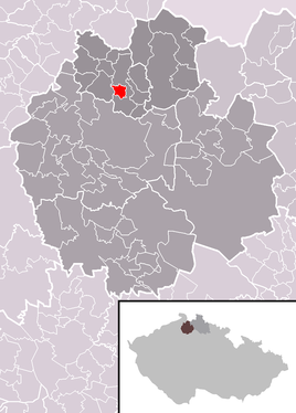
| Location of Chotovice in the Česká Lípa district | ||||

|
||||
Chotovice (German Kottowitz ) is a municipality in the Okres Česká Lípa in the Liberec region in the north of the Czech Republic .
history
The development of Kottowitz (originally obviously called Kotovice ) is seen in connection with the foundation of the Bürgstein Castle . In the middle of the 15th century the area belonged to the rule of Pihl, in the middle of the 17th century it became part of the Bürgstein rule of the Kolovrat. Their descendants, the Hroznata from Kokořov, sold the rule to the Kinskys. The first mention of the community can be found in the court tablets from 1455 (piscina juxtra villam Kotwicze) .
The population lived from agriculture, from the 18th century onwards they had an additional income from glass processing. Later the local farmers supplied the town of Haida , the nearby center of glass production, with dairy products. In administrative terms, Kottowitz formed a municipality in the judicial district of Haida and in the Bohemian Leipa district from the middle of the 19th century .
In 1880 there were 412 German-speaking residents in Kottowitz. With its cadastre, Kottowitz touches the area of Haida in the Neu-Kottowitz district, which merged with the town as the Hřebenka district in 1924. In addition to Neu-Kottowitz, which also had the district of New Italy , the municipality includes the deserted Skála (stone wall) on the road from Česká Lípa (Bohemian Leipa) to Nový Bor (Haida) . The Kottowitzer Berg or Kasperberg rises above Kottowitz. The Kottowitzer Bach flows through the municipality.
In 1838, the local farmer Wenzel Helzel founded a simple bath in the municipality that used a source of iron-rich water and peat that was extracted in the area around the Rotteich. In the course of time, the bathing area increased, where especially anemia (bleaching) and rheumatism were treated. A small park and a restaurant were also available for bathers. The bath was operated until 1945.
The beginnings of the local school system date back to the end of the Thirty Years' War, and a school of its own was opened on May 5, 1886. Classes ended shortly after World War II.
A monument in the community is the Chapel of the Visitation of Mary, built in 1776.
Personalities
- Franz Hantschel (1844–1940), doctor and local historian

