Holany
| Holany | ||||
|---|---|---|---|---|
|
||||
| Basic data | ||||
| State : |
|
|||
| Region : | Liberecký kraj | |||
| District : | Česká Lípa | |||
| Area : | 1876.8353 ha | |||
| Geographic location : | 50 ° 37 ′ N , 14 ° 30 ′ E | |||
| Height: | 265 m nm | |||
| Residents : | 519 (Jan 1, 2019) | |||
| Postal code : | 471 01 - 471 02 | |||
| License plate : | L. | |||
| structure | ||||
| Status: | Městys | |||
| Districts: | 5 | |||
| administration | ||||
| Mayor : | Josef Novák (status: 2007) | |||
| Address: | Holany 43 470 02 Česká Lípa 2 |
|||
| Municipality number: | 561584 | |||
| Website : | www.holany.cz | |||
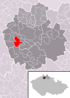
| Location of Holany in the Česká Lípa district | ||||

|
||||
Holany (German Hohlen ) is a minor town in the Okres Česká Lípa in the Liberec region in the north of the Czech Republic . It is located in the valley of the Bobří potok on the Holanský rybník (Hollow Lake) about nine kilometers southwest of Česká Lípa (Bohemian Leipa) . Daubaer Schweiz extends south of Holany .
history
According to the form of its name, Holany is one of the oldest Slavic settlements in the Česká Lípa district. It was first mentioned in writing in the middle of the 14th century, when Holany belonged to the Bergers. In the middle of the 15th century it came into the possession of the Wartembergers as part of the Rybnov estates. In the 16th century, these aristocrats united the area around Česká Lípa to form the Nový zámek estates and had their seat at the Zahrádky Castle.
Holany was a market center because of its convenient location. The sources refer to it as a town, although the population never exceeded 500. Its decline into a village began with the closure of the markets after the construction of the new roads at the beginning of the 19th century and was sealed by the fire of 1863. The inhabitants lived from small-scale trades, agriculture, mainly hops for export, pond farming and fruit growing.
Outstanding in the history of the place is the peasant uprising from 1680. From the middle of the 19th century the community belonged to the judicial district of Bohemian Leipa or the district of Bohemian Leipa .
Before the Munich conference, a fraternization celebration between Czechs and anti-fascist Germans took place here on August 28, 1938, the significance of which went beyond the boundaries of the district.
There is an architecturally valuable baroque church from 1785 in the village and a number of derelict fortresses and castles in the vicinity.
In 2006 the municipality was given the status of Městys .
Community structure
The municipality Holany consists of the districts Holany (Hohlen) , Hostíkovice (Hospitz) , Loubí (Lauben) , Oslovice (Wasslowitz) and Rybnov (Rübenau) . Basic settlement units are Holany, Hostíkovice, Loubí and Oslovice.
The municipality is divided into the cadastral districts of Holany and Loubí pod Vlhoštěm.
Web links
Individual evidence
- ↑ http://www.uir.cz/obec/561584/Holany
- ↑ Český statistický úřad - The population of the Czech municipalities as of January 1, 2019 (PDF; 7.4 MiB)
- ↑ http://www.uir.cz/casti-obce-obec/561584/Obec-Holany
- ↑ http://www.uir.cz/zsj-obec/561584/Obec-Holany
- ↑ http://www.uir.cz/katastralni-uzemi-obec/561584/Obec-Holany


