Kvítkov
| Kvítkov | ||||
|---|---|---|---|---|
|
||||
| Basic data | ||||
| State : |
|
|||
| Region : | Liberecký kraj | |||
| District : | Česká Lípa | |||
| Area : | 611.3148 ha | |||
| Geographic location : | 50 ° 39 ′ N , 14 ° 30 ′ E | |||
| Height: | 363 m nm | |||
| Residents : | 221 (Jan 1, 2019) | |||
| Postal code : | 471 01 | |||
| License plate : | L. | |||
| structure | ||||
| Status: | local community | |||
| Districts: | 1 | |||
| administration | ||||
| Mayor : | Jana Zelenková (as of 2006) | |||
| Address: | Kvítkov 57 470 01 Česká Lípa |
|||
| Municipality number: | 546259 | |||
| Website : | www.kvitkov.cz | |||
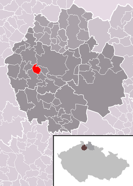
| Location of Kvítkov in the Česká Lípa district | ||||

|
||||
Kvítkov (German Quitkau , also Kwitkau ) is a municipality of the Okres Česká Lípa in the Liberec region in the north of the Czech Republic . To the east of the village the Robečský potok flows through the hell bottom .
history
The place was first mentioned in a document in 1295. From the middle of the 19th century, the community belonged to the judicial district of Bohemian Leipa or the district of Bohemian Leipa .
Community structure
No districts are designated for the municipality of Kvítkov. Basic settlement units are Kvítkov ( Quitkau ) and Podolí ( Halbemulde ).

