Blíževedly
| Blíževedly | ||||
|---|---|---|---|---|
|
||||
| Basic data | ||||
| State : |
|
|||
| Region : | Liberecký kraj | |||
| District : | Česká Lípa | |||
| Area : | 2096.4295 ha | |||
| Geographic location : | 50 ° 36 ' N , 14 ° 24' E | |||
| Height: | 361 m nm | |||
| Residents : | 626 (Jan. 1, 2019) | |||
| Postal code : | 471 04 - 472 01 | |||
| License plate : | L. | |||
| traffic | ||||
| Railway connection: | Řetenice – Lovosice – Česká Lípa – Liberec | |||
| structure | ||||
| Status: | local community | |||
| Districts: | 4th | |||
| administration | ||||
| Mayor : | Romana Dvořáková (as of 2006) | |||
| Address: | Blíževedly 10 471 04 Blíževedly |
|||
| Municipality number: | 561410 | |||
| Website : | www.blizevedly.liberecko.com | |||
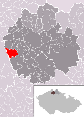
| Location of Blíževedly in the Česká Lípa district | ||||

|
||||
Blíževedly (German Bleiswedel ) is a municipality in the Okres Česká Lípa in the Liberec region on the border between the Bohemian Central Uplands and Daubaer Schweiz in the north of the Czech Republic . It is located on the side of the road from Litoměřice (Leitmeritz) to Zahrádky u České Lípy (Neugarten) (15), about 3 km south of the town of Kravaře v Čechách (Graber) and on the railway line from Česká Lípa (Bohemian Leipa) to Lovosice (Lobositz) .
history
The place was founded in 1290 and raised to a market town in 1292 by King Wenceslaus II . He was a parish from (around) 1384 and after a long break only again in 1754. It was devastated by a plague epidemic in 1713, and on September 8, 1784, 77 houses were burned in a severe conflagration.
Community structure
The municipality of Blíževedly consists of the following districts:
- Blíževedly (lead whisk) with stranné (stran)
- Litice (Litnitz) with Ráj (Rain)
- Skalka (Skalken)
- Hvězda (Sterndorf) with Vlhošť (Wilschhäuser)
The municipality is divided into the cadastral districts Blíževedly, Hvězda pod Vlhoštěm, Litice and Skalka u Blíževedel.
Attractions
On the town square there is a baroque Trinity column ( plague column ) by the Leitmeritz sculptor Franz Tollinger , which was erected in 1714 as thanks for the plague epidemic overcame in 1713. Likewise, the St. Baroque parish church consecrated to Wenceslaus has been preserved. To the east of Blíževedly is the 614 m high Vlhošť (Willhoscht) , the highest elevation in Daubaer Schweiz , in the north of the 553 m high Ronov (Ronberg) with the ruins of the Ronov Castle . The remains of the rock castle Hřídelík lie on the southwestern edge of the village .
Personalities
- Josef Köcher (1907–1997), politician (SPD)


