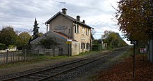
Jarville-la-Malgrange – Mirecourt railway line
| Jarville-la-Malgrange-Mirecourt | |||||||||||||||||||||||||||||||||||||||||||||||||||||||||||||||||||||||||||||||||||||||||||||||||||||||||||||||||||||||||||||||||||||||||||||||||||||||||||||||||||||||||||||||||||||||||||||||||||||
|---|---|---|---|---|---|---|---|---|---|---|---|---|---|---|---|---|---|---|---|---|---|---|---|---|---|---|---|---|---|---|---|---|---|---|---|---|---|---|---|---|---|---|---|---|---|---|---|---|---|---|---|---|---|---|---|---|---|---|---|---|---|---|---|---|---|---|---|---|---|---|---|---|---|---|---|---|---|---|---|---|---|---|---|---|---|---|---|---|---|---|---|---|---|---|---|---|---|---|---|---|---|---|---|---|---|---|---|---|---|---|---|---|---|---|---|---|---|---|---|---|---|---|---|---|---|---|---|---|---|---|---|---|---|---|---|---|---|---|---|---|---|---|---|---|---|---|---|---|---|---|---|---|---|---|---|---|---|---|---|---|---|---|---|---|---|---|---|---|---|---|---|---|---|---|---|---|---|---|---|---|---|---|---|---|---|---|---|---|---|---|---|---|---|---|---|---|---|
|
The Moselle bridge between Neuves-Maisons and Saint-Vincent, view upstream
| |||||||||||||||||||||||||||||||||||||||||||||||||||||||||||||||||||||||||||||||||||||||||||||||||||||||||||||||||||||||||||||||||||||||||||||||||||||||||||||||||||||||||||||||||||||||||||||||||||||
| Route number (SNCF) : | 040 000 | ||||||||||||||||||||||||||||||||||||||||||||||||||||||||||||||||||||||||||||||||||||||||||||||||||||||||||||||||||||||||||||||||||||||||||||||||||||||||||||||||||||||||||||||||||||||||||||||||||||
| Route length: | 57 km | ||||||||||||||||||||||||||||||||||||||||||||||||||||||||||||||||||||||||||||||||||||||||||||||||||||||||||||||||||||||||||||||||||||||||||||||||||||||||||||||||||||||||||||||||||||||||||||||||||||
| Gauge : | 1435 mm ( standard gauge ) | ||||||||||||||||||||||||||||||||||||||||||||||||||||||||||||||||||||||||||||||||||||||||||||||||||||||||||||||||||||||||||||||||||||||||||||||||||||||||||||||||||||||||||||||||||||||||||||||||||||
| Maximum slope : | 17 ‰ | ||||||||||||||||||||||||||||||||||||||||||||||||||||||||||||||||||||||||||||||||||||||||||||||||||||||||||||||||||||||||||||||||||||||||||||||||||||||||||||||||||||||||||||||||||||||||||||||||||||
| Top speed: | 90 km / h | ||||||||||||||||||||||||||||||||||||||||||||||||||||||||||||||||||||||||||||||||||||||||||||||||||||||||||||||||||||||||||||||||||||||||||||||||||||||||||||||||||||||||||||||||||||||||||||||||||||
| Dual track : | only between Jarville and Vézelize formerly continuously |
||||||||||||||||||||||||||||||||||||||||||||||||||||||||||||||||||||||||||||||||||||||||||||||||||||||||||||||||||||||||||||||||||||||||||||||||||||||||||||||||||||||||||||||||||||||||||||||||||||
|
|||||||||||||||||||||||||||||||||||||||||||||||||||||||||||||||||||||||||||||||||||||||||||||||||||||||||||||||||||||||||||||||||||||||||||||||||||||||||||||||||||||||||||||||||||||||||||||||||||||
The French railway line Jarville-la-Malgrange – Mirecourt in Lorraine has a length of 57 kilometers and connects in north-south direction the railway line Paris – Strasbourg near Nancy with the southern Mirecourt . This route is part of the main line Nancy- Langres , which continues behind Mirecourt via Merrey in the railway line Merrey-Hymont-Mattaincourt , a nearly 20 km long section of the railway line Culmont-Chalindrey-Toul and in the railway line Langres-Andilly . It is not electrified and today it is only expanded to a single track. The middle center Mirecourt is also the seat of the regional administration Communauté de communes de Mirecourt Dompaire . In Mirecourt there was a connection to the 78 km long Neufchâteau – Épinal railway line , which is no longer served today. The route is owned by the Réseau ferré de France and operated by the SNCF .
history
The construction of the line was declared of public interest and issued by decree on July 26, 1868 by Emperor Napoleon . It expressly refers to the connection with the Rhine-Marne Canal and the Jarville blast furnace as well as the mines at Vandœuvre and the brewery in Tantonville, founded in 1839 . It was also important that the national road 57 was connected. The construction should be carried out by the company and consorts . The construction cost was put at 1.435 million francs and budgeted for five years. The consortium consisted of Charles-Nicolas Which , lawyer and member of the Legion of Honor and President of the Development Company of the Chemin de fer de Nancy à Vézelise (CFNV) , Jean-Baptiste-Joseph Lenglet , banker and Vice President of the CFNV and Jean-Alexandre Hatzfeld , dealer, Member of the Legion of Honor and member of the CFNV.
In 1875, the company had to cede this route to the Chemin de fer de l'Est as a result of the lost Franco-German War and was incorporated into the Imperial Railways in Alsace-Lorraine . With the Vézelize – Mirecourt section, the last section was opened to traffic on December 22, 1879.
service
The service by the TER Champagne-Ardenne is extremely poor. There is currently only one continuous pair of trains that covers the 57 km long route in 70 minutes. Buses run at other times of the day and detours have to be accepted.
swell
- André Schontz, Arsène Felten, Marcel Gourlot: Le chemin de fer en Lorraine , Edition Serpenoise 1999, ISBN 2-87692-414-5
Individual evidence
- ↑ a b Collection complète des lois, décrets, ordonnances, réglements et avis du Conseil-d'État , 1868, ISSN 1762-4096 , p. 378
- ↑ a b Bulletin des lois No. 1636 , Imprimerie Royale, 1869, p. 544
- ↑ Annales des ponts et chaussées: mémoires et documents relatifs à l'art des constructions et au service de l'ingénieur , 1868, pp. 1369–1400
- ↑ Rapports et délibérations - Vosges, Conseil général , vol. 1880/08, p. 362
- ↑ SNCF: train no. 836483 , excerpt from the 2014/15 timetable


