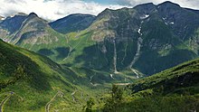
Balestrand
Balestrand is a village in the municipality of Sogndal in Fylke Vestland, Norway . It is located on the north bank of the Sognefjorden .
Surname
The name has been used for the Prestegjeld and the municipality since 1849 , which was established that year. The name was adopted from Hof Bale . It comes from the old Norse language ( bali ) and means "iron hill on the beach". According to a legend , the name comes from King Bele (Bale), who is said to be buried here.
Balestrand municipality
Until the end of 2019, Balestrand was a separate municipality. In the course of the local government reform in Norway , Balestrand was split up: Most of it was merged with the Leikanger municipality to form the new Sogndal municipality , the village of Nesse joined Høyanger after a referendum .
1279 inhabitants lived in an area of 430 km² (as of January 1, 2019). The municipality number was 1418.
coat of arms
Balestrand's coat of arms shows a downward-pointing silver sword on a blue background. The motif is inspired by the statue of King Bele on the Balehaugene . The coat of arms has been approved since 1989.
Tusenårssted
As Tusenårssted , the municipality chose the Balehaugane , in which two graves from the Iron Age were discovered.
Neighboring communities
Balestrand bordered Førde to the north, Sogndal and Leikanger to the east, Vik to the south and Høyanger and Gaular to the west .
Boundary changes
The boundary lines of Balestrand were changed in 1964 and 2000. The small island of Kvamsøy , which belonged to the municipality of Vik , was added to the municipality in 1964. In return, the Sogn Vangsnes was transferred to the municipality of Vik. Almost the entire area east of the mouth of the Fjærlandsfjord was incorporated into the municipality of Leikanger . Since 2000 the Sogn Fjærland belonged to the municipality of Sogndal .
places
- Balestrand
- Esebotn
- Ferns
- Menesegg (also known as Menes )
- Nessane
- Sværafjorden
- Sæle
- Tjugum / Dragsviki
- Vetlefjord
population
Population development
Personalities
- Adelsteen Normann , painter
- Hans Dahl , painter
- Hans Andreas Dahl , painter
- Franz Wilhelm Schiertz , painter
traffic
Riksvei 55 (Rv 55) ran through the municipality . Coming from Høyanger (in the municipality of Høyanger), the road leads through the Høyanger tunnel to the Lånefjord and further along the banks of the Sognefjorden to Tjugum / Dragsviki. There is a ferry connection over the Fjærlandsfjord to Hella (Rv 55) in the municipality of Leikanger or over the Sognefjord to Vangsnes (Rv 13) in the municipality of Vik. The Riksvei 13 (Rv 13) leads from Tjugum / Draksviki north along the Fjærland-, Sværa - and Vetlefjorden to the Vetlefjorddal . At the level of Bårddalen, the road bends to the east and follows the valley up into the mountains and finally reaches the municipality of Gaular. There are other ferry connections from Balestrand to Bergen and Flåm .
The nearest airport is in Kaupanger near Sogndal , approx. 65 km away.
Culture and sights
From 1890 Balestrand developed into an artist village. Adelsteen Normann was the first artist to have a villa built by the fjord in 1890/1891. In 1893 it was Hans Dahl who had a dragon-style villa built on the banks of the Sognefjord. In 1910 his son Hans Andreas Dahl followed him with his own house. Even today, exhibitions, painting courses and other artistic events take place in the restored artists' villas.
The Kviknes Hotel , built in Swiss style , is considered Norway's largest wooden house. The St. Olav Church is also worth seeing .
Web links
Individual evidence
- ↑ a b c Balestrand. In: store norske leksikon. Retrieved July 7, 2014 (Norwegian).
- ↑ Navn på nye kommuner. February 19, 2019, accessed January 13, 2020 (Norwegian).
- ↑ Svein Askheim: Balestrand. Store Norske Leksikon , accessed on March 28, 2020 (Norwegian).
- ↑ Day excursion to Bergen by express boat. Visit Norway, accessed March 28, 2020 .
Coordinates: 61 ° 10 ′ 39 ″ N , 6 ° 24 ′ 14 ″ E


