Barrow Island (Western Australia)
| Barrow Island | ||
|---|---|---|
| Barrow Island satellite photo | ||
| Waters | Indian Ocean | |
| Geographical location | 20 ° 50 ′ S , 115 ° 23 ′ E | |
|
|
||
| length | 27 km | |
| width | 11.5 km | |
| surface | 202 km² | |
| Highest elevation | 76 m | |
| Barrow Island on a map from 1897 | ||
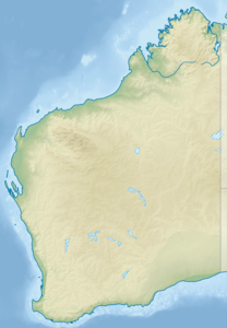
Barrow Island is a 202 km 2 island in the subtropics . It is located about 50 km northwest of the coast of Western Australia and belongs to the Ashburton Shire (within the Ashburton Ward ) in the Pilbara region . In the northeast, 7.4 km away, are the Lowendal Archipelago and 10 km further north are the archipelago of the Montebello Islands .
Discovery and Name
On the island there were indications of a settlement by the native inhabitants of Australia , the Aborigines , in the period from about 50,000 to 6,800 years ago, when a land connection to the continent disappeared due to the rise in sea level. Although the island has been repeatedly mentioned since the 16th century, it was only in 1816 by Phillip Parker King its current name by John Barrow , a British statesman and one of the founders of the Royal Geographical Society . Before that, in 1803, Nicolas Baudin sighted them on the Baudin expedition. But he thought it was mainland Australia.
Flora and fauna
Barrow Island is a spinifex grassland with numerous termite mounds , on which the mountain kangaroo , spectacled rabbit kangaroo , brush kangaroo , the golden shorthaired pouch and the Barrow Island mouse live. In addition to the endemic barrier reef turtle , the green turtle , hawksbill turtle and occasionally the loggerhead turtle can be found here. Seven types of toothed whales and three baleen whales were counted, even humpback whales stop in about 4100 ha large Barrow Iceland Marine Park temporarily and also dugongs . There are also significant coral reefs with tropical flora and numerous small fish in the waters of the marine park . There are 150 types of hard corals in the marine area. In addition to the marine park, the Barrow Island Marine Management Area encloses the sea area around the island, except for the south coast.
Among the 15 bird species are the endemic bird Malurus leucopterus edouardi , a subspecies of the white-winged easel tail , and the osprey .
Endemic fish such as the blind goby-like Milyeringa justitia , as well as troglobiote and amphibious species can be found in the limestone caves of the island .
Economic use
In 1954 crude oil was found on the island and has been exploited since 1964. Today 400 oil wells are active, which makes the island the largest oil production site in Australia . In 2009, work began on the world's largest liquefied gas production. The Gorgon gas project is expected to meet up to 8% of global demand . Asian customers in particular have signed contracts worth more than $ 200 billion.
environment
On April 10, 1996, the highest wind speed ever recorded on earth was recorded on Barrow Island at 408 km / h - apart from tornadoes .
Individual evidence
- ^ Evidence of the earliest occupation of the coasts of Australia from Barrow Island, Northwest Australia. In: phys.org. May 19, 2017, accessed June 15, 2017 .
- ^ Management Plan for the Montebello / Barrow Islands. Marine Conservation Reserves 2007–2017. Management plan no 55 . P. 8, in English
- ↑ Larson, HK, Foster, R., Humphreys, WF & Stevens, MI (2013): A new species of the blind cave gudgeon Milyeringa (Pisces: Gobioidei, Eleotridae) from Barrow Island, Western Australia, with a redescription of M. veritas Whitley. Zootaxa , 3616 (2): 135-150.
- ↑ faz.net: The magic word is liquid gas
- ↑ World Record Wind Gust: 408 km / h ( Memento from January 20, 2013 in the Internet Archive ) , WMO Info Note No. 58 of January 22, 2010, accessed February 4, 2010


