Bassari country
| Bassari country | |
|---|---|
|
UNESCO world heritage |
|

|
|
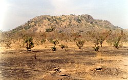
| At the foot of the Iwol plateau, the Bedik cultural landscape |
|
| National territory: |
|
| Type: | Culture |
| Criteria : | iii, v, vi |
| Surface: | 50,309 ha |
| Buffer zone: | 240,756 hectares |
| Reference No .: | 1407 |
| UNESCO region : | Africa |
| History of enrollment | |
| Enrollment: | 2012 (session 36) |
As a UNESCO World Heritage Site in the south-east of the West African state of Senegal, the Bassari country comprises three spatially separated areas: the cultural landscapes of the Bassari , Fula and Bedik . They lie between the Gambia river and the border with Guinea . The inclusion in the World Heritage took place in 2012.
Cultural landscapes of the Bassari, Fula and Bedik |
Geographical location
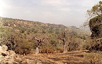
The three core areas of the cultural landscapes are located in difficult-to-access mountain regions of the Kédougou region . The Bassari area lies south of the Salémata prefecture , the Bedik area west of the village of Bandafassi on the Iwol plateau and the Fula area in the Dindéfelo highlands . The three peoples settled in these inaccessible areas, rich in natural resources and biodiversity, from the 11th to the 19th centuries. Until the last century, their villages were grouped on elevations to control the plains. They consisted of round, thatched huts that surrounded a central square. These traditional Bassari settlements are now only inhabited for ritual ceremonies or festivals and are therefore threatened with decay. The population chose to live near the fields instead of in the mountains.
Culture
The peoples of the Bassari, Fula and Bedik developed specific cultures that are in symbiosis with the surrounding natural environment and shaped their habitats in terms of sustainability . Archaeological evidence of early human settlement is abundant. The Bassari landscape is characterized by terraces and rice fields, interspersed with villages, hamlets and archaeological sites. The Bedik villages consist of dense groups of huts with steep thatched roofs.
The landscapes and their land use and settlement patterns, together with traditional architecture, sacred forests and sanctuaries, testify to a complex socio-economic cultural system in which particular agricultural and social practices, rituals, beliefs and traditional education have contributed to human settlement through the respectful and to ensure sustainable use of scarce resources in the long term. The inhabitants have preserved original agricultural, social, ritual and spiritual customs that are sustainably adapted to the given environmental conditions. It is a well-preserved multicultural landscape where original local cultures have remained alive.
Components of the world heritage site
| image | designation | year | Type | Ref. | description |
|---|---|---|---|---|---|
|
Cultural landscape of the Bassari ( location ) |
2012 | K | 1407 | The cultural landscape of the Bassari covers an area of 24,238 ha (buffer zone: 163,442 ha). | |
|
Cultural landscape of the Bedik ( location ) |
2012 | K | 1407 | The Bedik cultural landscape covers an area of 18,147 hectares (buffer zone: 65,731 hectares). | |
|
Fula cultural landscape ( location ) |
2012 | K | 1407 | The Fula cultural landscape covers an area of 7,924 ha (buffer zone: 11,583 ha). |
Web links
- Cultural landscapes of the Bassari, Fula and Bedik on the UNESCO World Heritage Center website ( English and French ).
- Proposition d'inscription sur la Liste du patrimoine mondial, République du Sénégal, January 2011 PDF file 28.7 MB


