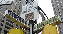
Bay Street
The Bay Street is about 3.8 km long road in the Canadian city of Toronto . In the figurative sense, the street name is often equated with Canada's financial services industry , as the main offices of the country's most important banks are located here ( metonymy ). Numerous insurance companies , renowned law firms and authorities are also represented here. In the southern area, the street is lined with numerous skyscrapers.
course
Bay Street runs immediately west of Yonge Street in a south-north direction. It begins at Queen's Quay on the shores of Lake Ontario , in the eastern part of the Harbourfront . It passes the Air Canada Center and the Central Railway Station ( Union Station ). At the intersection with Front Street are Brookfield Place (261 m) and the Royal Bank Plaza (180 m), the headquarters of the Royal Bank of Canada .
The next significant intersection is the one with King Street , which is considered the actual center of the Financial District and is surrounded on all four sides by the headquarters of major financial institutions: The Bank of Montreal in First Canadian Place (298 m, tallest habitable building in the city), the Scotiabank in Scotia Plaza (275 m), the Canadian Imperial Bank of Commerce in Commerce Court (239 m) and the Toronto-Dominion Bank in the Toronto-Dominion Center (223 m). In the 19th and early 20th centuries, the Bay / King intersection was still dominated by publishing houses for various newspapers. The financial services industry did not establish itself until the 1970s, when Montreal lost its status as Canada's leading business metropolis.
Immediately north of it, Bay Street crosses Adelaide Street. The Bay Adelaide Center (218 m) and the Adelaide Hotel Toronto (282 m) are located there. At the junction with Queen Street , the street swings slightly west. Bay Street ended here until the 1920s, but was then connected to Terauley Street and thus extended further north. This area forms Nathan Phillips Square , which is bordered by City Hall and the Old Town Hall .
The intersection of Bay Street and Dundas Street is the location of the Toronto Coach Terminal , Toronto's central bus station . The Toronto Police Service headquarters is located at the intersection of Bay Street and College Street; Opposite this is the College Park building , which was the headquarters of the department store chain Eaton's until the opening of the Eaton Center . The section to the north of it is dominated by buildings of the provincial government and the University of Toronto . The area around the intersection with Bloor Street is considered an exclusive shopping district. North of Bloor Street, Bay Street joins Davenport Road.
In the southern area of Bay Street, PATH , a system of pedestrian tunnels, creates underground connections to numerous side and cross streets.
literature
- Leonard Wise, Allan Gould: Toronto Street Names: An Illustrated Guide to Their Origins . Firefly Books, Toronto 2000, ISBN 1-55209-386-7 .
Web links
Coordinates: 43 ° 39 '26 " N , 79 ° 23' 3" W.


