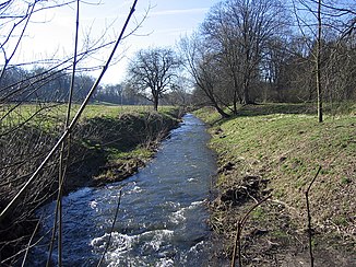
Beber (ears)
| Beber | ||
|
The Beber in Hundisburger Park |
||
| Data | ||
| location | Saxony-Anhalt , Germany | |
| River system | Elbe | |
| Drain over | Ohre → Elbe → North Sea | |
| source | near Bregenstedt (east slope of the Butterberg) 52 ° 14 ′ 26 ″ N , 11 ° 13 ′ 14 ″ E |
|
| Source height | approx. 130 m above sea level NN | |
| muzzle | at Wedringen (district of Haldensleben ) in the Ohre Coordinates: 52 ° 16 '54 " N , 11 ° 27' 24" E 52 ° 16 '54 " N , 11 ° 27' 24" E |
|
| Mouth height | 47 m above sea level NN | |
| Height difference | approx. 83 m | |
| Bottom slope | approx. 6.4 ‰ | |
| length | approx. 13 km | |
| Left tributaries | Row | |
| Right tributaries | Olbe , sheaf | |
| Small towns | Haldensleben ( Hundisburg , Althaldensleben ) | |
| Communities | Altenhausen (district of Emden ), Hohe Börde (district of Bebertal ) | |
The Beber is an approximately 13 km long tributary of the Ohre in Saxony-Anhalt .
It rises on the Butterberg near Bregenstedt from the source rivers Bregenstedter Krummbeek , Altenhäuser Riehe and the Erxleber Bach. The Beber flows through the towns of Emden and Bebertal , as well as the districts of Hundisburg and Althaldensleben in the city of Haldensleben and the Althaldensleben-Hundisburg landscape park . It flows into the ear at Wedringen .
