Ben Oss
| Ben Oss | ||
|---|---|---|
|
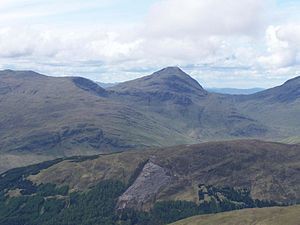
The Ben Oss from the north |
||
| height | 1029 m ASL | |
| location | Highlands , Scotland | |
| Notch height | 342 m | |
| Coordinates | 56 ° 23 '25 " N , 4 ° 46' 27" W | |
|
|
||
| rock | Mica slate | |
The Ben Oss (also Beinn Oss ) is a 1029 meter high mountain in Scotland . Its Gaelic name is interpreted differently, one assumption is the translation as mountain at the lake outflow or mountain at the outflow of the lake . More likely, however, is the mountain of the elk . Elk were extinct in Scotland as early as 1300. The mountain is located in the southern highlands between the places Crianlarich and Dalmally in Loch Lomond and the Trossachs National Park and is classified as Munro .

Despite its height, it is towered over by the neighboring Ben Lui to the west, which is the dominant mountain in the mountain group west of Crianlarich and Tyndrum with a total of four Munros. Together with the Beinn Dubhchraig to the east, the Ben Oss forms a semicircular wide ridge that opens to the south, from which the steep, rocky cone of the Ben Oss clearly protrudes. In the broad range, as Chur Garbh designated by two mountains formed Kar located hole Oss , a small lake. Beinn Dubchraig and Ben Oss are connected by the almost 780 meter high Bealach Buidhe saddle . To the north and northwest, the Ben Oss drops into the Glen Cononish with steep rock faces made of mica schist like the whole mountain . In the southwest, the Ben Oss and the Ben Lui are connected to the Ben Lui by a nearly 690 meter high saddle.
The Ben Oss lies on the watershed between the Scottish east and west coast. To the north it drains over the River Cononish into the Tay and the North Sea, to the southeast Loch Oss drains into the River Falloch , a tributary of Loch Lomond and thus into the Firth of Clyde . In the southwest several streams lead into the Glen Fyne and through this directly into Loch Fyne , a sea hole . Most Munro excavators climb Ben Oss together with Beinn Dubhchraig from the east, starting in Dalreigh near Tyndrum. The approach is also possible from the south from Gleann nan Caorann .
Individual evidence
- ↑ Munro List of the Scottish Mountaineering Club
- ↑ Peter Drummond: Scottish Hill and Mountain Names: The Origin and Meaning of the Names of Scotland's Hills and Mountains , Scottish Mountaineering Trust, 2010, ISBN 978-0-907521-95-2 , p. 203
Web links
- Ben Oss on walkhighlands.co.uk (English)
- The Ben Oss on munromagic.com (English)

