
Bloomfield (Indiana)
| Bloomfield | |
|---|---|
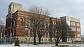
 Downtown view |
|
| Bloomfield in Greene County | |
 |
|
| Basic data | |
| State : | United States |
| State : | Indiana |
| County : | Greene County |
| Coordinates : | 39 ° 1 ′ N , 86 ° 56 ′ W |
| Time zone : | Eastern ( UTC − 5 / −4 ) |
| Residents : | 2,405 (as of 2010) |
| Population density : | 673.7 inhabitants per km 2 |
| Area : | 3.57 km 2 (approx. 1 mi 2 ) of which 3.57 km 2 (approx. 1 mi 2 ) is land |
| Height : | 185 m |
| Postal code : | 47424 |
| Area code : | +1 812 |
| FIPS : | 18-05716 |
| GNIS ID : | 431200 |
| Website : | www.bloomfieldin.com |
Bloomfield is a city in the US state of Indiana and the seat of the administration of Greene County .
geography
Geographical location
Bloomfield is located in central Greene County at an elevation of 185 m (606.9 feet ). Bloomfield is north of Martin and Daviess Counties , east of Sullivan Counties , south of Owen and Clay Counties, and west of Lawrence and Monroe Counties .
history
Bloomfield came into being in 1824 when Burlington, west of the White River, the county's previous administrative seat, no longer had a reliable water supply. The first building erected during the construction of the city was the Courthouse des Countys, the administrative seat.

Courthouse des Greene County
View of the west side

FLAK guns in front of the courthouse

Information board at the courthouse


Public facilities

Bloomfield Town Hall and Police Station

Bloomfield Public Library

"First Curch of Bloomfield", the "First Church of Blomfield" (Christian)

Methodist Church


Bloomfield has many public facilities. First of all, this is the town hall with the police station integrated into it, the city library and various churches.
Personalities
- Born in Bloomfield
- Barry Davis (born 1961), wrestler
- Oscar E. Bland (1877–1951), lawyer and politician
- Gerald W. Landis (1895–1971), politician
- Robert L. Letsinger (1921-2014), chemist
- Affiliated with Bloomfield
- Jackson Orr (1832-1926), politician, attended Indiana University in Bloomfield
- Lovell Harrison Rousseau (1818–1869), politician and officer, practiced as a lawyer in Bloomfield