Bracciano lake
| Bracciano lake | ||
|---|---|---|

|
||
| Geographical location | Central Italy | |
| Drain | Arrone | |
| Places on the shore |
Bracciano Trevignano Romano Anguillara Sabazia Rome |
|
| Data | ||
| Coordinates | 42 ° 7 '16 " N , 12 ° 13' 55" E | |
|
|
||
| Altitude above sea level | 164 m slm | |
| surface | 57.5 km² | |
| length | 9.3 km | |
| width | 8.7 km | |
| scope | 31.5 km | |
| Maximum depth | 160 m | |
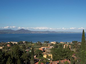
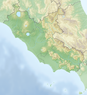
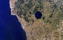
The Bracciano Lake ( Italian Lago di Bracciano , Latin Lacus Sabatinus ) is an almost circular lake in the Lazio region in central Italy . It is located about 33 km northwest of the city center of Rome and, with an average width of 9 km, is the second largest lake in the Lazio region after Lake Bolsena .
Emergence
Lake Bracciano lies in the volcanically active region of the Vulcano Sabatino and fills a caldera . Volcanic activity began about 600,000 years ago south of Monte Soratte and continued at several larger and smaller eruption sites, including the craters of Valle Baccano , Stracciacappa and Lago di Martignano . A magma chamber at a depth of 4 km emptied and finally collapsed. The resulting depression then filled with water. The eruptive phase of Vulcano Sabatino ended about 40,000 years ago. However, hot mineral springs and gas leaks in its vicinity are still evidence of the volcanic origin of Lake Bracciano.
geography
The Bracciano lake is surrounded by the volcanic Sabatine mountains , which rise to a height of 612 m slm. The lake's only outflow is the Arrone River , which has its source near Anguillara . The water level of the lake is regulated here by a lock built at the end of the 18th century . This is also where water is fed into the Aqua Paola , built in the early 17th century , which supplies the Roman district of Trastevere and the Vatican with water. Part of the water appears at the Fontana Paola .
A few kilometers from the east bank is the much smaller lake, Lago di Martignano .
The lakeside is shared by the municipalities of Anguillara Sabazia , Bracciano and Trevignano Romano .
protection
In 1999 the Parco Naturale Regionale di Bracciano-Martignano, which includes both Lake Bracciano and Lago di Martignano , was designated as a nature reserve. In order to protect the water quality of the water reservoir, the use of motor boats by private individuals is prohibited on the lake. Therefore, the lake is particularly suitable for water sports such as sailing, surfing or canoeing.
tourism
Lake Bracciano is a popular destination for local and foreign holidaymakers and day trippers. There are various beaches and campsites on the lakeshore. The name-giving place is Bracciano in the west with its Castello Orsini-Odescalchi castle, visible from afar . The medieval town of Anguillara Sabazia has a long promenade. In the north lies the also worth seeing Trevignano Romano . In the summer half of the year liner ships connect the towns on the lake.
On the south bank, near Vigna di Valle, is the Vigna di Valle Aviation Museum . The lake has been used by military and civilian flying boats in the past , including between 1937 and 1940 by British Imperial Airways as a stopover on flights between the United Kingdom and its colonies in Africa and Asia. In return for landing rights in Italy, the Italian Ala Littoria was allowed to use airfields in British colonies.
At Anguillara Sabazia there is an important Neolithic archaeological site in the lake , the findings of which are exhibited in the Museo Nazionale Preistorico Etnografico "Luigi Pigorini" in Rome. There are plans to build a museum village in the immediate vicinity of the original site.
Web links
- Bracciano Regional Park (Italian)
Individual evidence
- ^ Towns on Lake Bracciano. Lake Bracciano Booking Center (English) ( Memento of August 5, 2009 in the Internet Archive ).
- ^ Geologia del Parco. Website of the Regional Natural Park of Bracciano-Martignagno (Italian).
- ^ Geologia: Il distretto Sabatino. Parco di Veio website (Italian) ( Memento of July 5, 2009 in the Internet Archive ).
- ^ Lago sulle rotte dell'imperial airways. Blog entry in the La Voce del Lago blog from November 10, 2007 (Italian) ( Memento from February 18, 2013 in the web archive archive.today ).
- ↑ Il villaggio Neolitico "La Marmotta". Museum blog post from June 1, 2020 (Italian).
- ↑ Villaggio Neolitico. Anguillara Sabazia Parish, accessed June 6, 2020 (Italian).

