Buchberg (Tuggen)
| Buchberg | ||
|---|---|---|
|
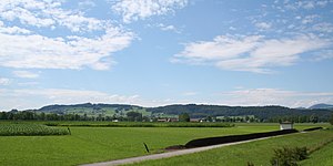
The Buchberg from the south |
||
| height | 631 m above sea level M. | |
| location | Canton of Schwyz , Switzerland | |
| Dominance | 4.2 km → Stockberg | |
| Notch height | 211 m ↓ Mülibach Canal | |
| Coordinates | 711 400 / 228873 | |
|
|
||
The Buchberg (also Buechberg ) is an elongated molasse hill in the canton of Schwyz and lies between Uznach and Nuolen .
Grynau Castle is at the northeast end . In the north, the Buchberg is flanked by the Linth and Lake Zurich and in the southeast by the municipality of Tuggen . The highest point is at its southwestern end at an altitude of 631 m above sea level. M. and rises more than 200 meters above Lake Zurich.
The Buchberg borders the Lin plateau and is affected by the 380 kV Sils – Fällanden line . The north-eastern part is crossed by the A53 . Bollinger sandstone is mined in a quarry .
Web links
Commons : Buechberg - collection of images, videos and audio files


