Caffaro
| Caffaro | ||
|
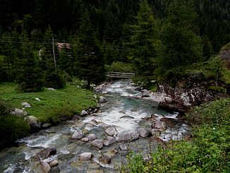
Upper course of the Caffaro |
||
| Data | ||
| location | Provinces of Brescia and Trento (Italy) | |
| River system | Po | |
| Drain over | Chiese → Oglio → Po → Adria | |
| River basin district | Padano | |
| source | in the Adamello massif ( Passo del Deadlines ) | |
| Source height | 2334 m slm | |
| muzzle | in the Chiese coordinates: 45 ° 48 ′ 38 ″ N , 10 ° 31 ′ 58 ″ E 45 ° 48 ′ 38 ″ N , 10 ° 31 ′ 58 ″ E |
|
| Mouth height | 368 m slm | |
| Height difference | 1966 m | |
| Bottom slope | 79 ‰ | |
| length | 25 km | |
| Catchment area | 120 km² | |
|
The confluence of the Caffaro and Chiese near Ponte Caffaro ( Pian d'Oneda ) |
||
The Caffaro ([ ˈkafːaro ]) is a river in the Alps and a tributary of the Chiese . Its valley is called the Valle del Caffaro .
The Caffaro rises in the Adamello massif near the border between the provinces of Brescia and Trento on Monte Listino . Fed by numerous mountain streams, it flows into and leaves the mountain lake Laghetto Dasaré , passes the historic city of Bagolino , and flows into the Chiese after about 40 km between Ponte Caffaro (belongs to the municipality of Bagolino) and Lodrone as a border river of the above-mentioned provinces and the respective regions , just before its confluence with Lake Idro . It now has a height difference of about 2200 m behind it.
Side by side with the river, the (Strada Provinciale) SP669 meanders uphill to Malga Gaver (mountain hut). There the road bends to the west and leads over the Passo di Croce Domini ( 1892 m slm ) into the neighboring valley of the Oglio , which flows through Lake Iseo .

