Camiri
| Camiri | ||
|---|---|---|
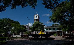
 July 12th Square with the San Francisco Church |
||
| Basic data | ||
| Residents (state) | 28,855 pop. (2012 census) | |
| rank | Rank 27 | |
| height | 812 m | |
| Post Code | 07-0706-0100-1001 | |
| Telephone code | (+591) 3952 | |
| Coordinates | 20 ° 2 ′ S , 63 ° 31 ′ W | |
|
|
||
| politics | ||
| Department | Santa Cruz | |
| province | Cordillera Province | |
| climate | ||
 Climate diagram Camiri |
||
Camiri is a medium- sized town in the Santa Cruz Department in the South American Andean state of Bolivia .
Location in the vicinity
Camiri is the central place of the district ( Bolivian : Municipio ) Camiri in the province of Cordillera . The village is located at an altitude of 811 m on the right bank of the Río Parapetí in a basin of the Sierra Caro Huayco , one of the southeastern suburbs of Bolivia.
geography
Camiri is in the area of the tropical climate, the six-month wet season extends from November to April and the dry season from May to October. The annual average temperature is 22.9 ° C, with 17 to 18 ° C from June to July and over 26 ° C from November to December. The annual precipitation is 875 mm, the wettest months are December and January with 175 mm and the driest months July and August with only 9 mm.
Transport network
Camiri is located 292 kilometers south of Santa Cruz , the capital of the department of the same name.
From Santa Cruz, the paved highway Ruta 9 leads south to Camiri, and from there another 258 kilometers further south to Yacuiba on the Argentine border.
Camiri has a small airport and a bus station, from which intercity buses go to Santa Cruz, Yacuiba and Sucre. Local public transport takes place with mini-buses and (radio) taxis.
There is a fairly large and well-stocked market near the city center, where you can buy groceries, household goods, fabric goods, handicrafts, etc.
population
The population of the city has increased significantly as a whole over the past three and a half decades, although the mid-1990s, the population in the meantime something had declined due to the privatization of the oil industry and related job losses:
| year | Residents | source |
|---|---|---|
| 1976 | 19 782 | census |
| 1992 | 27 971 | census |
| 2001 | 26 505 | census |
| 2012 | 28 855 | census |
Individual evidence
- ^ City population
- ↑ INE - Instituto Nacional de Estadística Bolivia 1992 ( Memento of the original from April 23, 2014 in the Internet Archive ) Info: The archive link was inserted automatically and has not yet been checked. Please check the original and archive link according to the instructions and then remove this notice.
- ↑ INE - Instituto Nacional de Estadística Bolivia 2001 ( Memento of the original from December 10, 2015 in the Internet Archive ) Info: The archive link has been inserted automatically and has not yet been checked. Please check the original and archive link according to the instructions and then remove this notice.
- ↑ INE - Instituto Nacional de Estadística Bolivia 2012 ( Memento of the original from March 4, 2016 in the Internet Archive ) Info: The archive link was inserted automatically and has not yet been checked. Please check the original and archive link according to the instructions and then remove this notice.
Web links
- Relief map of the Camiri region 1: 250,000 (PDF; 3.77 MB)
- Municipio Camiri - General Maps No. 70706
- Municipio Camiri - detailed map and population data (PDF; 776 kB) ( Spanish )
- Santa Cruz Department - Social data (PDF; 4.99 MB) ( Spanish )
