Canal latéral à l'Oise
| Canal latéral à l'Oise | |
|---|---|
|
Course sketch of the canal |
|
| Water code | FR : H0-3102 |
| location | France , Hauts-de-France region |
| length | 35 km |
| Built | 1823-1831 |
| class | IV from Noyon , before that I ( Freycinet class ) |
| Beginning | Crossing from the Canal de Saint-Quentin at Chauny |
| The End | Transition to the canalised Oise near Janville |
| Descent structures | 4th |
| Ports | Chauny, Pont-l'Évêque |
| Junctions, crossings | Canal du Nord , Canal de l'Oise à l'Aisne |
| Used river | Oise |
| Kilometrage | in the direction of flow of the Oise |
| Downhill | in the direction of flow of the Oise |
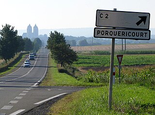
| View of the Oise valley near Noyon | |
The Canal latéral à l'Oise ( German Oise side canal ) is a French shipping canal that runs in the Hauts-de-France region .
geography
The canal is part of a supraregional inland waterway that connects the greater Paris area with north-west France, Belgium and the English Channel . This route consists of the following waterways:
- Seine - as a channeled river
- Oise - as a canalized river
- Canal latéral à l'Oise
- Canal du Nord
- Large shipping route Dunkirk-Scheldt
Course and technical infrastructure
The Canal latéral à l'Oise begins at Chauny , where it connects to the Canal de Saint-Quentin ( German: Canal of Saint-Quentin ). It flows into the river Oise near Janville just north of Compiègne , which can be navigated directly by ships from there up to its confluence with the Seine . In Pont-l'Évêque , near Noyon , it meets the Canal du Nord ( German: Nord-Kanal ), at Abbécourt the Canal de l'Oise à l'Aisne ( German: Oise-Aisne-Kanal ) branches off, the enables a connection to the east and south of France. It is a canal of the side canal type , it accompanies the river Oise over a length of 35 kilometers and overcomes a height difference of about 13 meters with the help of four locks . These are in the upper section for ships of the Freycinet class and from the confluence of the Canal du Nord also for larger ships ( grand gabarit ).
Coordinates
- Starting point of the canal: 49 ° 36 '25 " N , 3 ° 13' 22" E
- End point of the canal: 49 ° 27 ′ 47 ″ N , 2 ° 51 ′ 50 ″ E
Crossed departments
Places on the canal
history
Construction work began in 1823 and commissioning took place in 1831. The locks were originally built according to the Becquey standard and later converted to Freycinet dimensions. In the course of the construction of the Canal du Nord, all locks had to be rebuilt again to a uniform size, which is completely insufficient for today's requirements.
Economical meaning
Freight shipping between the Seine basin and the major ports on the Atlantic in northern France, Belgium and the Netherlands is still of great importance today. The existing waterway, however, by no means meets today's requirements.
Within the framework of the European Union , the Canal Seine-Nord Europe (CSNE) project was included in the transport route plan, which provides for the construction of a 106 km long canal in a south-north direction through northern France between the catchment areas of the Seine and Scheldt rivers . The existing Oise side canal between Compiègne and Noyon is to be expanded, with the exception of a new section between Thourotte and Ribécourt-Dreslincourt. A completely new route is planned from Noyon. Ships up to category Vb (push convoy with two barges) should be able to navigate the new inland waterway. The implementation work has already started and the canal is to be put into operation in 2016.
Web links
literature
- David Edwards-May: Inland Waters of France. 5th edition, Verlag Edition Maritim, Hamburg 1997, ISBN 3-922117-61-9 .
- Navicarte Guide de navigation fluvial - n ° 24 July 2005, Edition Grafocarte, ISBN 2-7416-0149-6 .
Individual proof
- ↑ a b The information on the length of the canal is based on the information on the Canal latéral à l'Oise at SANDRE (French), accessed on December 11, 2011, rounded to the nearest kilometer.

