
Carrickfergus (Borough)
| Carrickfergus Borough Buirg Charraig Fheargais |
|
|---|---|
  |
|
| geography | |
| Traditional county | County Antrim |
| surface | 82 km² |
| Administrative headquarters | Carrickfergus |
| ISO 3166-2 | GB-CKF |
| Demographics | |
| population | 39,096 (2012) |
| density | 477 inhabitants / km² |
| Denominations |
Protestants: 67.2% Catholics: 7.6% |
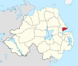
Carrickfergus ( Irish Carraig Fhearghais ) was one of the 26 Northern Irish districts that existed from 1973 to 2015. The district, whose area was in the traditional County of Antrim , had borough status . Important places in the borough were the city of Carrickfergus , which was also the administrative seat, as well as Greenisland and Whitehead . The District of Carrickfergus had the highest Protestant population of any district in Northern Ireland. On April 1, 2015, he was in the new District of Mid and East Antrim .
Carrickfergus Council
The election to the Carrickfergus Council on May 11, 2011 resulted in the following:
| Political party | 2011 result | Change from 2005 | |||
|---|---|---|---|---|---|
| Seats | be right | Seats | be right | ||
| Democratic Unionist Party (DUP) | 8th | 43.2% | 0 | −1.8% | |
| Ulster Unionist Party (UUP) | 4th | 15.9% | 0 | −3.1% | |
| Alliance Party | 3 | 25.1% | 0 | 5.7% | |
| Green party | 0 | 2.4% | 0 | 2.4% | |
| Independent | 2 | 13.5% | 0 | −3.2% | |
See also
Individual evidence
- ↑ Northern Ireland Population Estimates 2012 (XLS file)
- ↑ Northern Ireland Census 2011: Religion (administrative geographies)
- ^ Election result on BBC News (accessed July 26, 2011)
Antrim | Ards | Armagh | Ballymena | Ballymoney | Banbridge | Belfast | Carrickfergus | Castlereagh | Coleraine | Cookstown | Craigavon | Derry | Down | Dungannon and South Tyrone | Fermanagh | Larne | Limavady | Lisburn | Magherafelt | Moyle | Newry and Morne | Newtownabbey | North Down | Omagh | Strabane
Coordinates: 54 ° 44 ′ 0 ″ N , 5 ° 47 ′ 55 ″ W.