
Down (District)
| Down District Ceantar to Dúin |
|
|---|---|
  |
|
| geography | |
| Traditional county | County Down |
| surface | 647 km² |
| Administrative headquarters | Downpatrick |
| ISO 3166-2 | GB-DOW |
| Demographics | |
| population | 70,440 (2012) |
| density | 109 inhabitants / km² |
| Denominations |
Protestants 27.1% Catholics 57.5% |
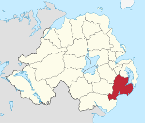
Down ( Irish An Dún ) was one of the 26 Northern Irish districts that existed from 1973 to 2015 and comprised part of the traditional county of Down . In the district, in addition to the administrative headquarters Downpatrick, were the places Ardglass , Ballynahinch , Castlewellan , Clough , Crossgar , Dundrum , Killough , Killyleagh , Newcastle , Saintfield , Seaforde and Strangford . On April 1, 2015, it went up in the new District of Newry, Morne and Down .
Down Council
The election to the Down Council on May 11, 2011 resulted in the following:
| Political party | 2011 result | Change from 2005 | |||
|---|---|---|---|---|---|
| Seats | be right | Seats | be right | ||
| Social Democratic and Labor Party (SDLP) | 9 | 34.2% | −1 | −3.3% | |
| Sinn Féin | 5 | 22.9% | 0 | −0.2% | |
| Democratic Unionist Party (DUP) | 3 | 16.4% | 0 | 0.1% | |
| Ulster Unionist Party (UUP) | 3 | 13.2% | −1 | −4.1% | |
| Alliance Party | 1 | 4.9% | 1 | 2.8% | |
| Green party | 1 | 4.1% | 0 | 0.8% | |
| Independent | 1 | 4.3% | 1 | 4.3% | |
See also
Individual evidence
- ↑ Northern Ireland Population Estimates 2012 (XLS file)
- ↑ Northern Ireland Census 2011: Religion (administrative geographies)
- ^ Election result on BBC News (accessed July 26, 2011)
Antrim | Ards | Armagh | Ballymena | Ballymoney | Banbridge | Belfast | Carrickfergus | Castlereagh | Coleraine | Cookstown | Craigavon | Derry | Down | Dungannon and South Tyrone | Fermanagh | Larne | Limavady | Lisburn | Magherafelt | Moyle | Newry and Morne | Newtownabbey | North Down | Omagh | Strabane
Coordinates: 54 ° 19 ′ 19 ″ N , 5 ° 42 ′ 11 ″ W.