
Antrim (Borough)
| Antrim Borough Buirg Aontroma |
|
|---|---|
  |
|
| geography | |
| Traditional county | County Antrim |
| surface | 577 km² |
| Administrative headquarters | Antrim |
| ISO 3166-2 | GB-ANT |
| Demographics | |
| population | 53,835 (2012) |
| density | 93 people / km² |
| Denominations |
Protestants: 43.2% Catholics: 37.5% |
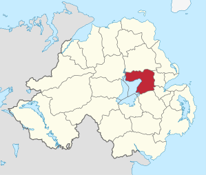
Antrim ( Irish : Aontroim ) was one of the 26 Northern Irish districts that existed from 1973 to 2015. The district, whose area was in the traditional County of Antrim , was established in 1973 and had borough status since 1977 . On April 1, 2015, he went on in the new District Antrim and Newtownabbey .
It comprised the north and east banks of Lough Neagh . Major places in the borough were Antrim , Toomebridge , Crumlin , Randalstown , Parkgate and Templepatrick . The Belfast airport was also in Borough.
Antrim Borough Council
The election for Antrim Borough Council on May 11, 2011 resulted in the following:
| Political party | 2011 result | Change from 2005 | |||
|---|---|---|---|---|---|
| Seats | be right | Seats | be right | ||
| Democratic Unionist Party (DUP) | 5 | 30.6% | −1 | −0.2% | |
| Ulster Unionist Party (UUP) | 5 | 20.8% | 0 | −3.0% | |
| Sinn Féin | 4th | 17.2% | +1 | 2.4% | |
| Social Democratic and Labor Party (SDLP) | 3 | 16.5% | 0 | −4.1% | |
| Alliance Party | 2 | 11.3% | 0 | 4.4% | |
| Traditional Unionist Voice | 0 | 2.1% | 0 | 2.1% | |
| Others | 0 | 0.6% | 0 | 0.0% | |
See also
Individual evidence
- ↑ Northern Ireland Population Estimates 2012 (XLS file)
- ↑ Northern Ireland Census 2011: Religion (administrative geographies)
- ^ Election result on BBC News (accessed July 26, 2011)
Antrim | Ards | Armagh | Ballymena | Ballymoney | Banbridge | Belfast | Carrickfergus | Castlereagh | Coleraine | Cookstown | Craigavon | Derry | Down | Dungannon and South Tyrone | Fermanagh | Larne | Limavady | Lisburn | Magherafelt | Moyle | Newry and Morne | Newtownabbey | North Down | Omagh | Strabane
Coordinates: 54 ° 43 ′ 0 ″ N , 6 ° 12 ′ 0 ″ W.