Caselow
|
Caselow
Community Bergholz
Coordinates: 53 ° 27 '2 " N , 14 ° 7' 44" E
|
|
|---|---|
| Height : | 30 m above sea level NHN |
| Area : | 4.57 km² |
| Residents : | 60 (2007) |
| Population density : | 13 inhabitants / km² |
| Incorporation : | January 1, 1957 |
| Postal code : | 17321 |
| Area code : | 039754 |
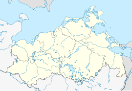
Location of Caselow in Mecklenburg-Western Pomerania |
Caselow is a district of the Bergholz community in the Vorpommern-Greifswald district with around 60 inhabitants.
Geographical location
The small town of Caselow is 2.5 kilometers west of Bergholz and 3 kilometers south of Rossow .
history
The first documentary mention as " in Coselow " is given with 1308, according to other sources already with 1305. The Landbuch der Mark Brandenburg from 1375 lists the place as Kozelow . Over the centuries the spelling varied from Kesselow (1416) and Kaselaw (1420) to Caselow (1443) and Castlow up to the current spelling " Caselow ", which was officially established in 1910 .
A Henning von Bentz resident in Caselow is mentioned around 1305 and a von der Hufe family between 1375 and 1487 . In 1375 there were 4 Kossatenhufen at the site of Caselow , which suggest the whereabouts of Slavic settlers from a nearby Slavic rampart, as well as 3 parish hooves, 8 free hooves, 1 jug, 2 mills and 19 Kossäthufen, of which 4 were desolate . From 1487 to 1685 Caselow belonged to the Löcknitz rule, initially owned by the von der Schulenburg until 1650 , then as a sovereign domain with an administrator owned by the Electors of Brandenburg and later Kings of Prussia.
Caselow was a domain and a forest district. It was administered in 1670 together with the villages of Bergholz , Grimme, Fahrenwalde and Zerrenthin , and from 1685 to 1823 it was initially part of the district of Löcknitz and between 1823 and 1872 it was part of the Brüssow department . Caselow also belonged to the Brüssow judicial office until 1849 and to the district court district of Brüssow from 1879 to 1952. From 1817 to 1900 the Heidemühle belonged to Caselow and in 1931 the residential area Forsthaus Caselow. Until 1948, the Soviet Military Administration in Germany (SMAD) expropriated land from large landowners , divided it up and redistributed it to farmers or displaced persons with a land reform in the Soviet Occupation Zone (SBZ) . In Caselow 492 hectares of land were expropriated and redistributed.
In 1956 Caselow was incorporated into Bergholz and has been part of the Bergholz community since 1957/1976 . In 1955 an LPG was founded in Caselow, which in 1957 became LPG Type III with 18 members and 156 hectares of land. In 1960 it already had 38 members and 368 hectares of land and in 1976 was incorporated into LPG Brüssow together with LPG Bergholz. Caselow has been the seat of a district forest ranger since 1978.
The manor house in Caselow was built 1895-1897 in the style of Schinkel's succession. It was inhabited until 1985, after which it fell into disrepair. It has been privately owned again since 2001 and has since been renovated to meet the requirements of listed buildings.
Population development
|
literature
- Lieselott Enders : Historical local dictionary for Brandenburg. Part 8: Uckermark. Böhlau, Weimar 1986, ISBN 3-7400-0042-2 ( publications of the State Archives Potsdam 21).
- Johannes Schultze (ed.): Das Landbuch der Mark Brandenburg from 1375 , publication of the historical commission for the province of Brandenburg and the imperial capital Berlin, VIII, 2, Berlin 1940
Individual evidence
- ^ Office Löcknitz-Penkun - SB Liegenschaften (ed.): Areas of the office area . Figures in hectares - as of June 2, 2017. Löcknitz August 2, 2017.
- ^ Research on German regional studies , S. Hirzel, 1865, p. 133 ( digitized version ).
- ↑ a b c d e f g h i j k Historical local dictionary for Brandenburg, Part VIII: Uckermark, Volume 1: A - L, Weimar 1986, p. 166 ff.
- ↑ Municipal directory Germany 1900. Prenzlau district.
- ^ A b Michael Rademacher: German administrative history from the unification of the empire in 1871 to the reunification in 1990. Prenzlau district. (Online material for the dissertation, Osnabrück 2006).
- ↑ Information brochure for the Löcknitz-Penkun Office 2007 , p. 3. (PDF)

