
Cayambe (volcano)
| Cayambe | ||
|---|---|---|
 Cayambe |
||
| height | 5796 m | |
| location | Ecuador | |
| Mountains | To the | |
| Dominance | 92.68 km → Cotopaxi | |
| Notch height | 2075 m | |
| Coordinates | 0 ° 1 ′ 44 ″ N , 77 ° 59 ′ 9 ″ W | |
|
||
| Type | Complex volcano | |
| Last eruption | 1786 | |
| First ascent | 1880 by Edward Whymper | |

The Cayambe is a complex volcano in the Andes in Ecuador .
The first ascent was made in 1880 by the British mountaineer Edward Whymper and his two Italian companions, the brothers Jean-Antoine and Louis Carrel .
Location and surroundings
The Cayambe is located approx. 60 km northeast of Quito , the capital of Ecuador . The city of Cayambe , named after the volcano, lies at its foot .
The summit of the Cayambe is at 5796 m, making the Cayambe the third highest mountain in Ecuador , after the Chimborazo and the Cotopaxi .
The summit of Cayambe is about 4 km north of the equator line . Until 2006, the southern reaches of the Cayambe Glacier was the only permanently white point on the equator. However, due to the retreat of the glaciers in recent decades, there is no longer an icy equator point. In the rainy season, however, the southern slope is often covered in snow, making it the only point on the entire equator line with regular snow.
photos
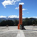
Cayambe as seen from the new equator monument

Cayambe as seen from Cuicocha crater

Glacier in the summit area


See also
Web links
- Cayambe in the Global Volcanism Program of the Smithsonian Institution (English)