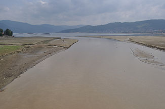
Cerna (river)
|
Cerna Cserna |
||
| Data | ||
| location | Districts Gorj , Mehedinți , Caraș-Severin ( Romania ) | |
| River system | Danube | |
| Drain over | Danube → Black Sea | |
| source |
Munții Godeanu ( Southern Carpathians ) 45 ° 15 ′ 50 ″ N , 22 ° 47 ′ 24 ″ E |
|
| muzzle | in the Danube near Orșova Coordinates: 44 ° 44 ′ 22 ″ N , 22 ° 24 ′ 44 ″ E, 44 ° 44 ′ 22 ″ N , 22 ° 24 ′ 44 ″ E
|
|
| length | 84 km | |
| Catchment area | 1433 km² | |
| Left tributaries | Șturu , Turcineasa , Râmnuța , Arsasca , Tăsna , Ogaşu lui Roşet , Șaua Padina , Jelărău , Padina Șoronişte , Fenigari , Bârzani , Pecinişca | |
| Right tributaries | Măneasa , Scurtu , Cărbunele , Valea lui Iovan , Balmez , Naiba , Curmezişa , Olanu , Craiova , Iauna , Topeniţa , iuta , Prisăcina , Drăstănicu , Bedina , Vânturătcarea , Slatina , Orgaşu Ursului , Clepeniac , Munk , Valea Mare , Belareca , Iardaşiţa , Sacherșița | |
| Reservoirs flowed through | Țierna , Prisaca , Barajul Iovanu | |
| Medium-sized cities | Orșova | |
| Small towns | Baile Herculane | |
| Communities | Topleț | |
The Cerna ( Hungarian Cserna ) is a left tributary of the Danube in Romania , which rises in the Gorj district .
Its source is on the southeast side of the Munții Godeanu , then it moves in a southwestern direction and flows into the Danube at Orșova . The upper part of the river is also called Cernișoara . Over a length of 84 km it crosses a valley with numerous, partly very deep gorges . Before it crosses the baths of Băile Herculane , it flows through the Țierna reservoir . During the Habsburg Monarchy , the Cerna formed the eastern border of the state.
The Cerna Valley is unique because - completely enclosed by mountain regions - it separates two different mountain ranges. It is a typical longitudinal valley that follows the tectonic line between the Vâlcan and the Mehedinţi mountains, bordered on one side by the Godeanu massif and on the other by the Cerna mountains . The numerous endo- karst forms of the Domogled-Valea Cernei National Park represent an exceptional scientific value both nationally and internationally .
References
- Administrația Naționalā Apelor Române - Cadastrul Apelor - Bucureşti
- Directiva Cadru 2000/60 a Uniunii Europene în Domeniul Apei - Județul Gorj
- Județul Gorj - Planul Județean de Apārare împotriva Inundațiilor
- Trasee turistice - județul Caraṣ
- Trasee turistice - județul Gorj
- Trasee turistice - județul Hunedoara
- Trasee turistice - județul Mehedinți
Individual evidence
- ↑ kreawerft.at ( page no longer available , search in web archives ) Info: The link was automatically marked as defective. Please check the link according to the instructions and then remove this notice. (PDF; 2.1 MB), “Green Mountain” A sustainability development model for overgrown mountain regions: Current situation analysis
