Chalaux (river)
| Chalaux | ||
|
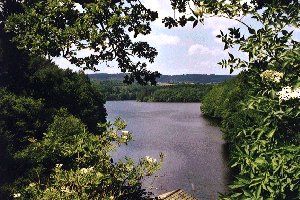
The Chaumeçon Reservoir |
||
| Data | ||
| Water code | FR : F3110600 | |
| location | France , Bourgogne-Franche-Comte region | |
| River system | His | |
| Drain over | Cure → Yonne → Seine → English Channel | |
| source | in the municipality of Planchez, 47 ° 8 ′ 59 ″ N , 4 ° 1 ′ 51 ″ E |
|
| Source height | approx. 630 m | |
| muzzle | on the municipal boundary of Marigny-l'Église and Saint-Germain-des-Champs in the Cure coordinates: 47 ° 22 ′ 55 ″ N , 3 ° 54 ′ 36 ″ E 47 ° 22 ′ 55 ″ N , 3 ° 54 ′ 36 ″ O |
|
| Mouth height | approx. 275 m | |
| Height difference | approx. 355 m | |
| Bottom slope | approx. 9.9 ‰ | |
| length | 36 km | |
| Reservoirs flowed through | Reservoir de Chaumeçon , Reservoir du Crescent | |
The Chalaux is a river in France that runs in the Nièvre department in the Bourgogne-Franche-Comté region . It rises in the Morvan des Morvan Massif Regional Nature Park , in the municipality of Planchez , generally drains in a north-west to north direction and, after 36 kilometers, joins the municipal boundary of Marigny-l'Église and Saint-Germain-des-Champs in the reservoir area of the Réservoir du Crescent on the left Tributary into the cure . Here it meets the border with the neighboring Yonne department .
Places on the river
Web links
Commons : Réservoir de Chaumeçon - collection of images, videos and audio files
Commons : Réservoir du Crescent - collection of images, videos and audio files
