Charlestown (Rhode Island)
| Charlestown | ||
|---|---|---|
|
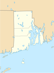
Location in Rhode Island
|
||
| Basic data | ||
| Foundation : | 1738 | |
| State : | United States | |
| State : | Rhode Island | |
| County : | Washington County | |
| Coordinates : | 41 ° 22 ′ N , 71 ° 40 ′ W | |
| Time zone : | Eastern ( UTC − 5 / −4 ) | |
| Residents : | 7,827 (as of 2010) | |
| Population density : | 82 inhabitants per km 2 | |
| Area : | 153.6 km 2 (approx. 59 mi 2 ) of which 95.4 km 2 (approx. 37 mi 2 ) is land |
|
| Height : | 18 m | |
| Postal code : | 02813 | |
| Area code : | +1 401 | |
| FIPS : | 44-14500 | |
| GNIS ID : | 1220080 | |
| Website : | www.charlestownri.org | |
Charlestown is a city in Washington County in the US state of Rhode Island .
history
Charlestown, named after King Charles II , was founded in 1738 . The area was previously part of the city of Westerly . It was then divided and the part north of the Pawcatuck River became the city of Richmond in 1747 .
Attractions
The Ninigret National Wildlife Refuge is located southwest of the city on the site of the former Naval Auxiliary Air Station Charlestown .
Personalities
- Joseph Stanton (1739–1807), politician
Web links
Commons : Charlestown (Rhode Island) - Collection of pictures, videos, and audio files
- Charlestown in the Encyclopedia Astronautica (English)
