Richmond (Rhode Island)
| Richmond | ||
|---|---|---|
|
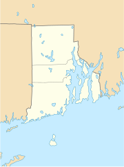
Location in Rhode Island
|
||
| Basic data | ||
| State : | United States | |
| State : | Rhode Island | |
| County : | Washington County | |
| Coordinates : | 41 ° 30 ′ N , 71 ° 40 ′ W | |
| Time zone : | Eastern ( UTC − 5 / −4 ) | |
| Residents : | 7,708 (as of 2010) | |
| Population density : | 73.4 inhabitants per km 2 | |
| Area : | 105.6 km 2 (approx. 41 mi 2 ) of which 105.0 km 2 (approx. 41 mi 2 ) are land |
|
| Height : | 116 m | |
| Postcodes : | 02800-02899 | |
| Area code : | +1 401 | |
| FIPS : | 44-61160 | |
| GNIS ID : | 1220089 | |
Richmond is a city in Washington County , Rhode Island , United States .
geography
Richmond is dominated by agriculture and is located about 35 km southwest of Providence , the capital of Rhode Island. The urban area is largely forested and has an area of 105.6 km² with an average height of 43 m above sea level. To the west of the city runs the Wood River , to the north and east is the area of the city of Exeter , to the east that of South Kingstown . In the south the urban area borders on the Pawcatuck River . Interstate 95 runs through the eastern part of the city between New Haven and Providence.
The actual center of Richmond is not a closed settlement, it consists of a widely scattered group of houses around the Richmond Town Hall and the elementary school ( Richmond Elementary School ). Due to the peculiarities of the administrative structure of New England , the villages of Alton, Arcadia, Carolina, Hope Valley, Kenyon, Shannock, Usquepaugh, Woodville and Wyoming are in the urban area of Richmond.
population
In the 2000 census there were 7222 inhabitants. Almost 97% of them were white . The per capita income was $ 22,351, with 3% of the population living below the poverty line . By 2010 the population increased by 6.7% to 7708 inhabitants.
history
The area of southern Rhode Island - and thus also that of later Richmond - was originally inhabited by the Narraganset Indians. From the beginning of the 17th century, British emigrants began to settle, who increasingly spread into New England and founded colonies .
Due to ongoing disputes between the English colonies in Rhode Island, Connecticut and Massachusetts , King Charles II placed the disputed area under his own administration in 1665 and named it King 'County . In 1669 the county was first converted to the city of Westerly, and then gradually divided into the four separate areas of Westerly , Charlestown , Richmond and Hopkinton . In 1774, Richmond was founded as the last of the four areas as an independent city under the administrative law of the New England states.
Like many other cities and towns in Rhode Island, the settlers benefited from the abundant hydropower, so that a small industry of wool, textile and iron processing could develop in the Richmond area, which gathered around a few mills.
Today neither agriculture nor small industry play a role in Richmond. Most of the residents work outside the urban area, which is valued as a residential area due to its rural character.
The National Register of Historic Places has four properties in Richmond, the Carolina Village Historic District , the John Hoxsie House , the Shannock Historic District, and the Wyoming Village Historic District .
Web links
Individual evidence
- ↑ Richmond at GeoNames
- ↑ US Census 2010
- ↑ Town of Richmond, RI - Our Town's History. ( Memento of the original from June 28, 2009 in the Internet Archive ) Info: The archive link was inserted automatically and has not yet been checked. Please check the original and archive link according to the instructions and then remove this notice.
