South Kingstown
| South Kingstown | ||
|---|---|---|
 Washington County Courthouse |
||
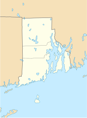
| Location in Rhode Island | ||
|
|
||
| Basic data | ||
| Foundation : | 1722 | |
| State : | United States | |
| State : | Rhode Island | |
| County : | Washington County | |
| Coordinates : | 41 ° 27 ′ N , 71 ° 32 ′ W | |
| Time zone : | Eastern ( UTC − 5 / −4 ) | |
| Residents : | 30,639 (as of 2010) | |
| Population density : | 207.2 inhabitants per km 2 | |
| Area : | 206.6 km 2 (approx. 80 mi 2 ) of which 147.9 km 2 (approx. 57 mi 2 ) is land |
|
| Height : | 30 m | |
| Postcodes : | 02879, 02883, 02892 | |
| Area code : | +1 401 | |
| FIPS : | 44-67460 | |
| GNIS ID : | 1220090 | |
| Website : | www.southkingstownri.com | |
South Kingstown is a city in Washington County , Rhode Island , United States . The county seat of Washington County is located in the Village West Kingston within South Kingstown.
geography
South Kingstown is located a few kilometers west of Narragansett Bay about 50 kilometers southwest of Providence south of the Providence Metropolitan Area , a metropolitan area on the Atlantic coast with 1.5 million inhabitants around Providence, about 40 km southwest of Boston and 200 km northeast of New York .
The urban area has an area of 147.9 km², the mean height is 21 m above sea level. Due to the peculiarities of the administrative structure of New England , several villages are located in the urban area of South Kingstown, in addition to Wakefield and Peace Dale these are Curtis Corner , Green Hill , Indian Lake Shore , Kingston , Matunuck , Middlebridge , Perryville , Rocky Brook , Snug Harbor , Tuckertown , Usquepaugh and West Kingston . The urban area is largely forested and has many smaller and larger ponds and lakes, the largest of which is the Worden Pond in the east of the city. West of the city, the tidal estuary of the Pettaquamscutt River , the Pettaquamscutt Cove , extends into the urban area.
To the east of the urban area connection is made to the US Highway 1 , which runs parallel to the coast and North Kingston and the Rhode Iceland State Route 4 to Interstate 95 meets to Providence. To the west of the city runs the historic Amtrak northeast line , which has a train station in West Kingston .
population
South Kingstown had a population of 27,921 in the 2000 census . 91% of the population were white , 3% Asian and about 1.5% each African American and American Indian . The remainder was divided among different ethnic groups. The per capita income was $ 23,827, with about 5.3% of the population living below the poverty line . By 2010 the population grew by 9.7% to 30,639 inhabitants.
history
The land of the later city was originally inhabited by the Narraganset . In 1674, Kings Town was founded in southern Rhode Island, whose large administrative area also included the later cities of South Kingstown and North Kingstown . In 1723 South Kingstown was separated from North Kingstown as a separate administrative unit.
Due to the long history of Rhode Island as one of the earliest American settlement areas, there are numerous National Historic Places in the city area , including Kingston Railroad Station on the Amtrak northeast line in West Kingston.
Web links
- South Kingston Geographic Information System
- Pettaquamscutt Historical Society , South Kingston Historical Society
Individual evidence
- ↑ South Kingstown at GeoNames
- ↑ US Census 2010
- ↑ Pettaquamscutt Historical Society ( Memento of the original from June 1, 2008 in the Internet Archive ) Info: The archive link was inserted automatically and has not yet been checked. Please check the original and archive link according to the instructions and then remove this notice.
